Category:Maps of the Algerian railway network
Jump to navigation
Jump to search
Subcategories
This category has the following 2 subcategories, out of 2 total.
Media in category "Maps of the Algerian railway network"
The following 30 files are in this category, out of 30 total.
-
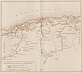
 Carte des chemins de fer de l'Algérie et de la Tunisie, 1914.jpg 1,461 × 1,054; 580 KB
-
 Carte du reseau PLM algérien, 1937.png 1,903 × 1,385; 3.35 MB
-
 Carte du réseau PLM algérien, 1930.jpg 1,678 × 1,469; 499 KB
-

-
 Chemin de fer en algérie (2015).png 1,256 × 748; 662 KB
-
 Chemins de fer algeriens publié en 1957.jpg 3,213 × 1,360; 1.17 MB
-
 Chemins de Fer de Paris à Lyon et à la Méditerranée (Réseau Algérien) - 1930.png 5,566 × 4,639; 42.43 MB
-
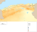
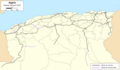 Map of the Algeria railway network - Carto (2023).png 4,800 × 2,800; 1.19 MB
-
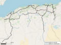
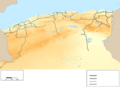
 Map of the Algeria railway network - OSM (2022).png 4,800 × 2,800; 5.25 MB
-
 Map of the Algeria railway network - OSM (2023) - V2.png 4,800 × 2,800; 5.26 MB
-
 Map of the Algeria railway network - OSM (2023).png 6,400 × 4,800; 11.83 MB
-
 Map of the Algeria railway network - Topo G (2023) - fr.png 4,800 × 2,800; 8.21 MB
-
 Map of the Algeria railway network - Topo G (2023) - Stations - fr.png 4,800 × 2,800; 8.19 MB
-
 Map of the Algeria railway network - Topo G (2023) - Struct.png 4,800 × 2,800; 3.93 MB
-
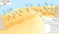 Map of the Algerian railway network (1900) - ar.png 4,800 × 2,798; 8.2 MB
-
 Map of the Algerian Railway Network (1900) - blank.png 4,800 × 4,150; 1.73 MB
-
 Map of the Algerian railway network (1900) - fr.png 4,800 × 2,800; 2.16 MB
-
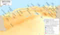
 Map of the Algerian Railway Network (1930) - ar.png 4,800 × 2,800; 8.63 MB
-
 Map of the Algerian Railway Network (1930) - blank.png 4,800 × 3,500; 1.86 MB
-
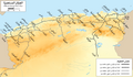
 Map of the Algerian Railway Network (1930) - fr.png 4,800 × 2,800; 2.65 MB
-
 Map of the Algerian railway network - Topo Y (2023) - Stations - ar.png 4,800 × 2,800; 10.42 MB
-
 Map of the Algerian railway network - Topo Y (2023) - Stations - blank.png 4,800 × 2,800; 6.33 MB
-
 Map of the Algerian railway network - Topo Y (2023) - Stations - fr.png 4,800 × 2,800; 6.67 MB
-
 Operating railway of Algeria (2007).svg 165 × 99; 41 KB
-
 Railway network of Algeria.svg (2007).svg 195 × 118; 62 KB
-
 Recto d'une carte des horaires des trains (SNTF), 1977 -V2.jpg 1,073 × 882; 201 KB
-
 Recto d'une carte des horaires des trains (SNTF), 1977.jpg 1,084 × 934; 341 KB
-
 Routes et chemins de fer de l'Algérie - Carte ancienne de 1914.jpg 1,481 × 922; 378 KB
-
 Réseau ferré algérien en 1900.png 4,800 × 2,800; 826 KB
-
 Réseau ferré algérien en 1930.png 4,800 × 3,600; 1.22 MB


.png)

_-_1930.png)
.png)
.png)
_-_V2.png)
.png)
_-_fr.png)
_-_Stations_-_fr.png)
_-_Struct.png)
_-_ar.png)
_-_fr.png)
_-_ar.png)
_-_fr.png)
_-_Stations_-_ar.png)
_-_Stations_-_fr.png)
.svg)
.svg)
,_1977_-V2.jpg)
,_1977.jpg)


_-_blank.png)
_-_blank.png)
_-_Stations_-_blank.png)