Category:Maps of states and territories of Australia
Jump to navigation
Jump to search
Countries of Oceania: Australia
Subcategories
This category has the following 12 subcategories, out of 12 total.
Media in category "Maps of states and territories of Australia"
The following 64 files are in this category, out of 64 total.
-
 ACT in Australia map.png 200 × 186; 11 KB
-
 Adobt-Australia states map.png 2,000 × 1,860; 110 KB
-
 Arnold Guyot03.jpg 500 × 456; 59 KB
-
 As map.png 329 × 352; 10 KB
-
 Aus NSW map.png 328 × 352; 26 KB
-
 Aus NT map.png 328 × 352; 25 KB
-
 Aus QLD map.png 328 × 352; 25 KB
-
 Aus SA map.png 328 × 352; 26 KB
-
 Aus TAS map.png 328 × 352; 25 KB
-
 Aus VIC map.png 328 × 352; 26 KB
-
 Austraaliahaldus.png 500 × 426; 25 KB
-
 Australia Color Map.svg 2,323 × 1,917; 194 KB
-
 Australia eastern states.png 314 × 284; 6 KB
-
 Australia lane filtering legality.png 1,280 × 922; 153 KB
-
 Australia location map recolored MR.png 1,911 × 1,543; 224 KB
-
 Australia location map recolored.png 2,190 × 1,577; 133 KB
-
 Australia location map with floral.png 2,190 × 1,577; 179 KB
-
 Australia locator-MJC (no whitespace).png 497 × 450; 72 KB
-
 Australia locator-MJC coloured (labelled) NL.png 497 × 450; 39 KB
-
 Australia locator-MJC coloured (labelled).png 497 × 450; 97 KB
-
 Australia locator-MJC coloured.png 497 × 450; 72 KB
-
 Australia locator-MJC.png 563 × 476; 69 KB
-
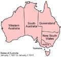 Australia states 1901-1911.png 500 × 468; 46 KB
-
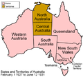
 Australia states 1911-1927.png 500 × 468; 52 KB
-
 Australia states 1927-1931.png 500 × 468; 54 KB
-
 Australia states 1931-present.png 500 × 468; 52 KB
-
 Australia states and territories blank.svg 791 × 790; 53 KB
-
 Australia states and territories labelled.svg 791 × 790; 58 KB
-
 Australia states blank.png 2,000 × 1,870; 19 KB
-
 Australia States Map - Colours with White Borders.svg 658 × 602; 72 KB
-
 Australia states map.jpg 475 × 436; 126 KB
-
 Australia states map.png 200 × 186; 11 KB
-
 Australia states map.svg 200 × 186; 13 KB
-
 Australia states named thai.png 500 × 468; 22 KB
-
 Australia states named.png 500 × 468; 17 KB
-
 Australia States Territories heb.png 427 × 369; 36 KB
-
 Australia states territories.svg 1,204 × 884; 1.02 MB
-
 Australia-administrative map PL.png 1,021 × 809; 196 KB
-
 Australia.png 314 × 284; 2 KB
-
 Australian Capital Territory locator-MJC.png 563 × 476; 13 KB
-
 Australian states by ruling party.svg 2,055 × 1,846; 894 KB
-
 Australian states map th.svg 200 × 186; 347 KB
-
 Australian states map.svg 460 × 420; 11 KB
-
 AustraliaNumbered.png 938 × 878; 57 KB
-
 AustraliaStatesTerritoriesNumb.png 400 × 374; 37 KB
-
 Australie politicka mapa.png 2,190 × 1,800; 249 KB
-
 Australiese state af.png 350 × 324; 31 KB
-
 Australiese state af2.svg 1,361 × 1,231; 133 KB
-
 Avtralia kort.png 390 × 364; 5 KB
-
 Bundesstaaten Australiens.png 350 × 324; 29 KB
-
 Carte des états australiens copie.png 800 × 576; 81 KB
-
 Christmas Island (Australia) map.png 330 × 355; 4 KB
-
 Coldest temperatures recorded in Australian States and Territories.png 6,000 × 5,655; 1.38 MB
-
 Cosos (Keeling) Islands (Australia) map.png 329 × 355; 6 KB
-
 Forest cover in Australian states and territories.png 3,000 × 2,778; 521 KB
-
 Hottest temperatures recorded in Australian States and Territories.png 6,000 × 5,556; 1.34 MB
-
 Koori map.png 800 × 576; 79 KB
-
 Map of Australia States - Grey with White Borders.svg 658 × 602; 88 KB
-
 Map of Australia.png 328 × 352; 20 KB
-
 Map of British Australia.jpg 3,552 × 2,927; 2.36 MB
-
 NSRW Map of Australia.png 1,474 × 1,111; 960 KB
-
 Queensland locator-MJC.svg 200 × 186; 5 KB
-
 SEQ location map.svg 1,200 × 1,800; 652 KB
-
 States and Territories of Australia - AR.png 1,000 × 930; 53 KB


.png)
_NL.png)
.png)


_map.png)

_Islands_(Australia)_map.png)


