Category:Maps of self-determination
Jump to navigation
Jump to search
Media in category "Maps of self-determination"
The following 21 files are in this category, out of 21 total.
-
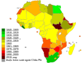 Africa independence dates vi.svg 1,300 × 1,000; 208 KB
-
 Africa independence dates.svg 1,300 × 1,000; 208 KB
-
 Annibyniaeth gwledydd 4.svg 2,389 × 1,189; 222 KB
-
 Estados de reconocimiento limitado.png 1,920 × 942; 230 KB
-
 Formación de los países del mundo.png 2,644 × 1,196; 163 KB
-
 Limited recognition (simplier scheme).svg 2,756 × 1,399; 244 KB
-
 Limited recognition 2014.PNG 1,248 × 626; 66 KB
-
 Limited recognition 2017.png 1,248 × 660; 48 KB
-
 Limited Recognition states.svg 422 × 207; 1.35 MB
-
 Limited recognition.png 1,100 × 550; 20 KB
-
 Limited recognition2014.PNG 1,248 × 660; 46 KB
-
 Limited recognition3.png 1,248 × 660; 29 KB
-
 List of countries gained independance from the UK 2.svg 2,389 × 1,189; 222 KB
-
 List of countries gained independence from the UK Flag version 3.svg 2,400 × 1,189; 364 KB
-
 List of Countries that have gained independece from Spain (Catalan version).svg 1,070 × 535; 164 KB
-
 List of Countries that have gained independece from Spain Euskara.svg 1,070 × 535; 165 KB
-
 Map of countries that gained independence from the UK Catalan version.svg 2,389 × 1,189; 222 KB
-
 Map of Countries that have gained independence from Spain Part 2.svg 600 × 535; 351 KB
-
 Map of Countries that have gained independence from Spain Whole.svg 1,070 × 535; 350 KB
-

-
 Recognition problems.jpg 1,100 × 547; 121 KB


.svg)


.svg)


