Category:Maps of rivers of Algeria
Jump to navigation
Jump to search
Media in category "Maps of rivers of Algeria"
The following 19 files are in this category, out of 19 total.
-
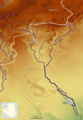
 99531312 o.jpg 1,240 × 970; 764 KB
-
 CarteOuedNamous.png 554 × 540; 165 KB
-
 Endiguement des oueds.jpg 1,030 × 1,090; 305 KB
-
 France & Colonies-1894-Oued Righ.jpg 2,788 × 4,488; 2.14 MB
-
 Haciane Menkoub.jpg 1,853 × 1,317; 315 KB
-
 Isser Basin OSM.png 843 × 850; 1.32 MB
-
 Macta carte.jpg 2,045 × 1,346; 312 KB
-
 Medjerda Bassin OSM.png 3,024 × 2,079; 8.71 MB
-
 Mzab-ouargla-righ.png 1,236 × 724; 33 KB
-
 Oued Isser OSM.png 349 × 457; 131 KB
-
 Oued Righ.png 346 × 543; 42 KB
-
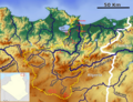
 Rhumel Kebir Basin OSM.png 1,500 × 1,051; 2.68 MB
-
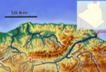
 Rhummel location map.png 2,688 × 2,669; 422 KB
-
 Río Chelif 2.jpg 1,436 × 1,161; 1.48 MB
-
 Saoura OSM.png 2,278 × 3,294; 10.62 MB
-
 Sebaou Basin OSM.png 1,228 × 835; 1.62 MB
-
 Seybouse Basin.png 1,531 × 1,172; 2.93 MB
-
 Soummam Basin OSM.png 1,550 × 1,134; 3.09 MB
-
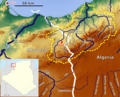 Tafna Bassin OSM.png 1,370 × 1,111; 2.22 MB


