Category:Maps of regions of Italy
Jump to navigation
Jump to search
Countries of Europe: Albania · Austria · Belarus · Belgium · Bosnia and Herzegovina · Bulgaria · Croatia · Czech Republic · Denmark · Finland · France‡ · Georgia‡ · Germany · Hungary · Iceland · Italy · Kazakhstan‡ · Latvia · Luxembourg · Malta · Montenegro · Netherlands‡ · North Macedonia · Poland · Portugal‡ · Romania · Russia‡ · Serbia · Slovakia · Slovenia · Spain‡ · Switzerland · Turkey‡ · Ukraine · United Kingdom
Limited recognition: Kosovo
‡: partly located in Europe
Limited recognition: Kosovo
‡: partly located in Europe
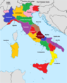
- Regions of Italy: Abruzzo · Aosta Valley · Apulia · Basilicata · Calabria · Campania · Emilia-Romagna · Friuli-Venezia Giulia · Lazio · Liguria · Lombardy · Marche · Molise · Piedmont · Sardinia · Sicily · Trentino-South Tyrol · Tuscany · Umbria · Veneto
Subcategories
This category has the following 5 subcategories, out of 5 total.
Media in category "Maps of regions of Italy"
The following 160 files are in this category, out of 160 total.
-
 Italia-Province 2.png 235 × 275; 20 KB
-
 18 compartimenti statistici.jpg 3,475 × 3,967; 743 KB
-
 Administrative Regions of Italy.png 800 × 1,005; 175 KB
-
 Compartimento del Piemonte.svg 890 × 1,024; 216 KB
-
 Compartimento del Veneto.svg 890 × 1,024; 225 KB
-
 Compartimento dell'Emilia.svg 890 × 1,024; 224 KB
-
 Compartimento della Campania.svg 890 × 1,024; 217 KB
-
 Compartimento della Liguria.svg 890 × 1,024; 206 KB
-
 Compartimento della Lombardia.svg 890 × 1,024; 234 KB
-
 Compartimento della Sardegna.svg 890 × 1,024; 216 KB
-
 Compartimento della Sicilia.svg 890 × 1,024; 221 KB
-
 Compartimento della Toscana.svg 890 × 1,024; 229 KB
-
 Compartimento delle Calabrie.svg 890 × 1,024; 204 KB
-
 Compartimento delle Marche.svg 890 × 1,024; 209 KB
-
 Compartimento delle Puglie.svg 890 × 1,024; 208 KB
-
 Compartimento di Abruzzi e Molise.svg 890 × 1,024; 217 KB
-
 Hierarchical Clustering Italy.jpg 217 × 250; 11 KB
-
 Itaalia maakonnad.png 514 × 600; 99 KB
-
 Italian provinces (1992).svg 512 × 660; 307 KB
-
 Italian provinces no regions ka.svg 1,200 × 1,500; 1.66 MB
-
 Italian provinces no regions.svg 1,200 × 1,500; 1.64 MB
-
 Italian provinces.svg 512 × 660; 357 KB
-
 Italian regions provinces asturian.svg 1,200 × 1,500; 1.61 MB
-
 Italian Wine Regions.jpg 1,108 × 1,097; 167 KB
-
 Italien Regionen Metropolitanstädte.png 1,830 × 2,177; 135 KB
-
 Italien, Verwaltungseinheiten mit gotischer Backsteinarchitektur.png 1,830 × 2,177; 159 KB
-
 Italië Genumerde Regio's.png 300 × 350; 25 KB
-
 Italy Base Map.png 2,370 × 2,812; 406 KB
-
 Italy map with provinces.svg 1,200 × 1,500; 556 KB
-
 Italy map with regions blank.svg 1,200 × 1,500; 316 KB
-
 Italy map with regions numbered 2.svg 1,200 × 1,500; 639 KB
-
 Italy map with regions numbered NUTS.svg 1,200 × 1,500; 286 KB
-
 Italy map with regions numbered.svg 1,200 × 1,500; 373 KB
-
 Italy provincial location map 2015.svg 1,034 × 1,299; 3.03 MB
-
 Italy regions (cs).png 2,136 × 2,406; 750 KB
-
 Italy regions (he).png 2,289 × 2,583; 914 KB
-
 Italy regions (it).png 1,211 × 1,464; 477 KB
-
 Italy regions (ko).png 1,195 × 1,346; 447 KB
-
 Italy regions (ru).png 2,009 × 2,263; 856 KB
-
 Italy regions (zh-hans).png 2,536 × 2,863; 1.36 MB
-
 Italy regions.png 2,289 × 2,583; 983 KB
-
 Italy regions.svg 1,200 × 1,500; 767 KB
-
 Italy, administrative divisions (regions+provinces) - de - colored.svg 1,034 × 1,299; 2.14 MB
-
 Italy, administrative divisions (regions+provinces) - de - monochrome.svg 1,034 × 1,299; 2.14 MB
-
 Italy, administrative divisions (regions+provinces) - Nmbrs - colored.svg 1,034 × 1,299; 2.32 MB
-
 Italy, administrative divisions (regions+provinces) - Nmbrs - monochrome.svg 1,034 × 1,299; 2.32 MB
-
 Italy, administrative divisions (regions+provinces) - XY - colored.svg 1,034 × 1,299; 2.44 MB
-
 Italy, administrative divisions (regions+provinces) - XY - monochrome.svg 1,034 × 1,299; 2.45 MB
-
 Italy, administrative divisions - de (provinces).svg 1,034 × 1,299; 2.32 MB
-
 Italy, administrative divisions - de - colored, Noto font.svg 1,032 × 1,298; 1.51 MB
-
 Italy, administrative divisions - de - colored.svg 1,034 × 1,299; 1.17 MB
-
 Italy, administrative divisions - de.svg 1,034 × 1,299; 1.17 MB
-
 Italy, administrative divisions - en - colored.svg 1,032 × 1,298; 1.47 MB
-
 Italy, administrative divisions - es - colored.svg 1,032 × 1,298; 1.48 MB
-
 Italy, administrative divisions - fr - colored.svg 1,032 × 1,298; 1.51 MB
-
 Italy, administrative divisions - it - colored.svg 1,032 × 1,298; 1.48 MB
-
 Italy, administrative divisions - ja - colored.svg 1,032 × 1,298; 1.44 MB
-
 Italy, administrative divisions - Nmbrs (provinces).svg 1,034 × 1,299; 1.94 MB
-
 Italy, administrative divisions - Nmbrs - colored.svg 1,034 × 1,299; 1.32 MB
-
 Italy, administrative divisions - Nmbrs.svg 1,034 × 1,299; 1.03 MB
-
 Italy, administrative divisions - th - colored.svg 1,034 × 1,299; 1.51 MB
-
 Italy, administrative divisions - XY (provinces).svg 1,034 × 1,299; 2.45 MB
-
 Italy, administrative divisions - zh-hans - colored.svg 1,032 × 1,298; 1.4 MB
-
 Italy, administrative divisions - zh-hant - colored.svg 1,032 × 1,298; 1.44 MB
-
 Italy-Regions ja-it.svg 1,134 × 1,063; 227 KB
-
 Italy.geohive.gif 620 × 723; 30 KB
-

-
 Map of Italian provinces (1954).svg 1,200 × 1,500; 542 KB
-
 Map of Italian provinces (1964).svg 1,200 × 1,500; 541 KB
-
 Map of Italian provinces (1968).svg 1,200 × 1,500; 544 KB
-
 Map of Italian provinces (1970).svg 1,200 × 1,500; 545 KB
-
 Map of Italian provinces (1974).svg 1,200 × 1,500; 546 KB
-
 Map of Italian provinces (1992).svg 1,200 × 1,500; 555 KB
-
 Map of Italian provinces - animated.gif 960 × 1,200; 508 KB
-
 Map of Italy blank (green).png 3,750 × 4,688; 771 KB
-
 Map of Italy blank (green).svg 1,200 × 1,500; 611 KB
-
 Map of Italy blank.svg 1,200 × 1,500; 822 KB
-
 Map of Italy with macro regions WLM.svg 1,200 × 1,500; 420 KB
-
 Map of Italy.jpg 2,935 × 3,521; 2.26 MB
-
 Mapa de Italia (subdivisiones).svg 2,167 × 2,769; 3.38 MB
-
 Mappa DTT Italia.svg 1,200 × 1,500; 294 KB
-
 Mappa regioni con movimenti indipendentisti.png 480 × 600; 75 KB
-
 Administrative map of Italy showing regions, provinces and communes.png 1,632 × 2,112; 198 KB
-
 Gemeinden Italien 2018.png 3,000 × 3,592; 2.93 MB
-
 Gemeinden Italien 2023.png 5,000 × 6,295; 5.93 MB
-
 Gemeinden Italien 2024.png 5,000 × 5,986; 5.36 MB
-
 Mezzogiorno regioni storiche.png 4,000 × 4,000; 2.5 MB
-
 NUTS-1 IT.svg 735 × 867; 125 KB
-
 Presidenza delle regioni.png 220 × 274; 26 KB
-
 Province e compartimenti del Regno d'Italia.svg 890 × 1,024; 456 KB
-
 Provincia di Perugia (o dell'Umbria).svg 890 × 1,024; 204 KB
-
 Provincia di Potenza (o della Basilicata).svg 890 × 1,024; 203 KB
-
 Provincia di Roma (o del Lazio).svg 890 × 1,024; 202 KB
-
 RegijeItalije.png 400 × 396; 38 KB
-
 Regionen in Italien beschriftet.png 1,108 × 1,097; 80 KB
-
 Regionen Italiens.PNG 1,101 × 1,305; 265 KB
-
 Regioni of Italy with ligurian names.PNG 606 × 600; 81 KB
-
 Regioni of Italy with official names color.png 1,108 × 1,097; 57 KB
-
 Regioni of Italy with official names.png 1,108 × 1,097; 90 KB
-
 Regioni, province e comuni italiani.svg 800 × 1,030; 3.8 MB
-
 Regions of Italy with en-wiki names.png 1,108 × 1,097; 146 KB
-
 Regions of Italy with Italian Names.svg 1,200 × 1,500; 29 KB
-
 Regions of Italy with official names.png 1,108 × 1,097; 115 KB
-
 Regions of Italy.png 300 × 350; 34 KB
-
 Regions, provinces and municipalities in Italy.svg 666 × 791; 87.78 MB
-

-
 Tre Venezie.jpg 3,475 × 3,967; 584 KB
-
 Tre Venezie.svg 890 × 1,016; 308 KB
-
 Unioni Comuni Agrigento.png 904 × 365; 67 KB
-
 Unioni Comuni Alessandria.png 1,458 × 743; 194 KB
-
 Unioni Comuni Ancona.png 1,196 × 622; 94 KB
-
 Unioni Comuni Ascoli Piceno.png 1,134 × 556; 57 KB
-
 Unioni Comuni Asti.png 1,052 × 782; 175 KB
-
 Unioni Comuni Avellino.png 1,027 × 583; 70 KB
-
 Unioni Comuni Bergamo.png 942 × 736; 84 KB
-
 Unioni Comuni Biella.png 1,020 × 770; 97 KB
-
 Unioni Comuni Biella2.png 1,052 × 782; 99 KB
-
 Unioni Comuni Bologna.png 1,233 × 694; 108 KB
-
 Unioni Comuni Brescia.png 990 × 751; 131 KB
-
 Unioni Comuni Caltanissetta.png 942 × 726; 61 KB
-
 Unioni Comuni Campobasso.png 896 × 680; 77 KB
-
 Unioni Comuni Catania.png 881 × 700; 71 KB
-
 Unioni Comuni Cosenza.png 813 × 694; 54 KB
-
 Unioni Comuni Cremona.png 1,131 × 668; 111 KB
-
 Unioni Comuni Cuneo.png 1,237 × 821; 194 KB
-
 Unioni Comuni Ferrara.png 1,393 × 529; 65 KB
-
 Unioni Comuni Forlì-Cesena.png 1,031 × 637; 57 KB
-
 Unioni Comuni Gorizia.png 523 × 703; 38 KB
-
 Unioni Comuni Isernia.png 877 × 684; 48 KB
-
 Unioni Comuni Lecce.png 1,035 × 711; 145 KB
-
 Unioni Comuni Lodi.png 800 × 610; 57 KB
-
 Unioni Comuni Macerata.png 940 × 697; 68 KB
-
 Unioni Comuni Messina.png 1,071 × 607; 110 KB
-
 Unioni Comuni Milano.png 980 × 520; 72 KB
-
 Unioni Comuni Modena.png 739 × 628; 48 KB
-
 Unioni Comuni Nuoro.png 1,062 × 762; 95 KB
-
 Unioni Comuni Oristano.png 1,009 × 736; 112 KB
-
 Unioni Comuni Palermo.png 948 × 448; 72 KB
-
 Unioni Comuni Parma.png 768 × 640; 70 KB
-
 Unioni Comuni Pavia.png 1,152 × 689; 135 KB
-
 Unioni Comuni Pesaro Urbino.png 1,190 × 563; 75 KB
-
 Unioni Comuni Piacenza.png 1,124 × 643; 91 KB
-
 Unioni Comuni Ravenna.png 1,018 × 621; 45 KB
-
 Unioni Comuni Reggio Emilia.png 727 × 613; 56 KB
-
 Unioni Comuni Rieti.png 993 × 565; 72 KB
-
 Unioni Comuni Rimini.png 884 × 658; 57 KB
-
 Unioni Comuni Roma.png 961 × 458; 51 KB
-
 Unioni Comuni Salerno.png 1,015 × 578; 74 KB
-
 Unioni Comuni Sassari.png 1,140 × 627; 94 KB
-
 Unioni Comuni Sud Sardegna.png 1,089 × 661; 125 KB
-
 Unioni Comuni Taranto.png 838 × 405; 46 KB
-
 Unioni Comuni Torino.png 1,425 × 778; 288 KB
-
 Unioni Comuni Trapani.png 562 × 434; 28 KB
-
 Unioni Comuni VCO.png 1,176 × 779; 108 KB
-
 Unioni Comuni Vercelli.png 708 × 741; 57 KB
-
 Unioni di Comuni in provincia di Alessandria.png 1,280 × 743; 210 KB
-
 Włochy-mapa administracyjna.png 805 × 1,030; 229 KB
-
 이탈리아 행정구역.svg 1,034 × 1,299; 1.36 MB
-
 이탈리아의 주.png 967 × 1,216; 292 KB
-
 이탈리아의 프로빈차.svg 1,200 × 1,500; 1.66 MB


.svg)


.png)
.png)
.png)
.png)
.png)
.png)


_-_de_-_colored.svg)
_-_de_-_monochrome.svg)
_-_Nmbrs_-_colored.svg)
_-_Nmbrs_-_monochrome.svg)
_-_XY_-_colored.svg)
_-_XY_-_monochrome.svg)
.svg)


.svg)


.svg)


.jpg)
.svg)
.svg)
.svg)
.svg)
.svg)
.svg)


.svg)


.svg)
.svg)
.svg)


_(14784247632).jpg)


.png)
.svg)