Category:Maps of provinces of Iraq
Jump to navigation
Jump to search
Subcategories
This category has the following 21 subcategories, out of 21 total.
A
- Maps of Anbar Province (12 F)
B
- Maps of Babylon Province (8 F)
- Maps of Baghdad Province (6 F)
- Maps of Basra Province (9 F)
D
- Maps of Dhi Qar Province (6 F)
- Maps of Diyala Province (8 F)
- Maps of Dohuk Province (16 F)
H
- Maps of Halabja Province (9 F)
K
- Maps of Karbala Province (7 F)
- Maps of Kirkuk Province (31 F)
M
- Maps of Maysan Province (6 F)
- Maps of Muthanna Province (9 F)
N
- Maps of Najaf Province (6 F)
Q
- Maps of Qadisiyyah Province (13 F)
S
- Maps of Saladin Province (9 F)
- Maps of Sulaymaniyah Province (60 F)
W
- Maps of Wasit Province (6 F)
Media in category "Maps of provinces of Iraq"
The following 20 files are in this category, out of 20 total.
-
 2 digit postcode iraq.png 885 × 885; 59 KB
-
 Administrative divisions of Iraq.svg 379 × 381; 270 KB
-
 Diwaniya regions.jpg 551 × 471; 109 KB
-
 Irak Provinzengrenzen 1991.png 1,000 × 1,000; 146 KB
-
 Iraq Base Map.png 1,107 × 694; 354 KB
-
 Iraq Dist.png 1,260 × 1,084; 74 KB
-
 Iraq Governorates 2015(numbered).png 2,000 × 2,037; 507 KB
-
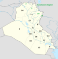 Iraq provinces Numbered (2024).png 1,280 × 1,304; 453 KB
-
 Iraq Provinces.jpg 643 × 584; 29 KB
-
 Iraqi Governorates (numbered).png 300 × 301; 32 KB
-
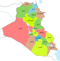 Iraqi Governorates ar.svg 1,241 × 1,264; 314 KB
-
 Iraqi Governorates including partially recognized Halabja ar.svg 1,241 × 1,264; 366 KB
-
 Iraqi Governorates including partially recognized Halabja.svg 1,241 × 1,264; 323 KB
-
 Iraqi Governorates ku-latn.svg 1,241 × 1,264; 313 KB
-
 Iraqi governorates map.png 1,280 × 1,304; 290 KB
-
 Iraqi Governorates mk.svg 1,241 × 1,264; 404 KB
-
 Iraqi Governorates.svg 1,241 × 1,264; 313 KB
-
 IraqNumberedRegions new png version.png 2,000 × 2,006; 406 KB
-
 التقسيمات الإدارية لمحافظة النجف.png 1,168 × 1,749; 386 KB
-
 محافظات العراق.png 1,880 × 1,840; 302 KB


.png)
.png)

.png)


