Category:Maps of provinces of Gabon
Jump to navigation
Jump to search
| Upload media | |||||
| Subclass of | |||||
|---|---|---|---|---|---|
| Location |
| ||||
| |||||
Subcategories
This category has the following 7 subcategories, out of 7 total.
E
- Maps of Estuaire Province (3 F)
O
- Maps of Ogooué-Lolo Province (6 F)
W
- Maps of Woleu-Ntem Province (4 F)
Media in category "Maps of provinces of Gabon"
The following 30 files are in this category, out of 30 total.
-
 GA-1 Estuaire.svg 404 × 438; 35 KB
-
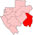
 GA-2 Haut-Ogooué.svg 404 × 438; 35 KB
-
 GA-3 Moyen-Ogooué.svg 404 × 438; 35 KB
-
 GA-4 Ngounié.svg 404 × 438; 35 KB
-
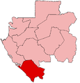
 GA-5 Nyanga.svg 404 × 438; 35 KB
-
 GA-6 Ogooué-Ivindo.svg 404 × 438; 35 KB
-
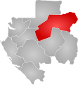
 GA-7 Ogooué-Lolo.svg 404 × 438; 35 KB
-
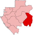
 GA-8 Ogooué-Maritime.svg 404 × 438; 35 KB
-
 GA-9 Woleu-Ntem.svg 404 × 438; 35 KB
-
 Gabon Base Map.png 756 × 997; 312 KB
-
 Gabon Estuaire.png 428 × 448; 7 KB
-
 Gabon Haut-Ogooue.png 428 × 448; 7 KB
-
 Gabon Ngounie.png 428 × 448; 7 KB
-
 Gabon provinces blank.png 2,000 × 2,136; 27 KB
-
 Gabon provinces named and numbered.png 500 × 534; 262 KB
-
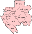 Gabon provinces named Arabic.png 500 × 533; 38 KB
-
 Gabon provinces named.png 500 × 534; 20 KB
-
 Gabon provinces numbered.png 300 × 320; 9 KB
-
 Gabon siyasi haritası.svg 600 × 600; 398 KB
-
 Gabon-Estuaire.png 150 × 160; 3 KB
-
 Gabon-Haut-Ogooue.png 150 × 160; 3 KB
-
 Gabon-Moyen-Ogooue.png 428 × 448; 7 KB
-
 Gabon-Ngounie.png 150 × 160; 3 KB
-
 Gabon-Nyanga.png 428 × 448; 7 KB
-
 Gabon-Ogooue-Ivindo.png 428 × 448; 7 KB
-
 Gabon-Ogooue-Lolo.png 428 × 448; 7 KB
-
 Gabon-Ogooue-Maritime.png 428 × 448; 7 KB
-
 Gabon-Woleu-Ntem.png 428 × 448; 7 KB
-
 Gabon98-color.svg 467 × 558; 55 KB
-
 Gabon98.svg 1,000 × 1,072; 60 KB


