Category:Maps of provinces
Jump to navigation
Jump to search
Subcategories
This category has the following 2 subcategories, out of 2 total.
*
C
Media in category "Maps of provinces"
The following 8 files are in this category, out of 8 total.
-
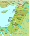
 Levantine Ajnad.png 1,389 × 2,340; 783 KB
-
 Map of country subdivisions (provinces).svg 863 × 443; 1.54 MB
-
 Mapa de Colombia (provincias).svg 1,420 × 1,896; 2.79 MB
-
 Ottoman empire at Europe.PNG 1,306 × 1,694; 482 KB
-
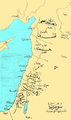
 Syria in the 9th century-ar.svg 422 × 516; 1.5 MB
-
 Syria in the 9th century-ar2.png 449 × 548; 380 KB
-
 Syria in the 9th century.svg 431 × 521; 1.81 MB
-
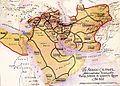 Wilayah Abbasiyyah semasa khalifah Harun al-Rashid.jpg 600 × 430; 92 KB

.svg)
.svg)


