Category:Maps of protected areas in Washington (state)
Jump to navigation
Jump to search
States of the United States: Alabama · Alaska · Arizona · Arkansas · California · Colorado · Florida · Georgia · Hawaii · Idaho · Illinois · Indiana · Iowa · Kansas · Kentucky · Louisiana · Maine · Maryland · Massachusetts · Michigan · Minnesota · Mississippi · Missouri · Montana · Nebraska · Nevada · New Hampshire · New Jersey · New Mexico · New York · North Carolina · Ohio · Oklahoma · Oregon · Pennsylvania · South Carolina · South Dakota · Tennessee · Texas · Utah · Vermont · Virginia · Washington · West Virginia · Wisconsin · Wyoming – Washington, D.C.
American Samoa · Puerto Rico · United States Virgin Islands
American Samoa · Puerto Rico · United States Virgin Islands
Subcategories
This category has the following 6 subcategories, out of 6 total.
M
N
O
Media in category "Maps of protected areas in Washington (state)"
The following 11 files are in this category, out of 11 total.
-
 Enchantment Lakes map.jpg 1,352 × 665; 169 KB
-
 Enchantment Lakes Topo.png 1,289 × 594; 1.22 MB
-
 Vancouver National Historic Reserve ownership map 2003.jpg 1,146 × 711; 429 KB
-
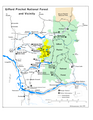 Gpnf vicinity.png 1,275 × 1,650; 407 KB
-
 Iceberg Point Map San Juan Islands (33852889571).jpg 1,650 × 1,284; 299 KB
-
 Joseph Canyon Map.gif 312 × 365; 25 KB
-
 Map of Pioneer Square Historic District - cleaned and corrected.jpg 948 × 777; 260 KB
-
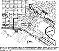 Map of Pioneer Square Historic District.jpg 1,000 × 855; 164 KB
-
 Mbsweb1.png 1,136 × 1,521; 839 KB
-
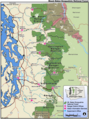
 Mount St. Helens map - Flickr - brewbooks.jpg 2,845 × 2,375; 2.76 MB
-
 Watmough Bay Map San Juan Islands (33852889251).jpg 1,650 × 1,284; 200 KB


.jpg)


.jpg)