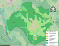
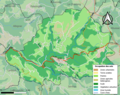
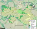
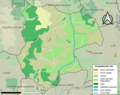
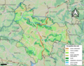
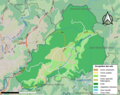
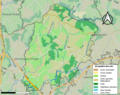
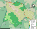
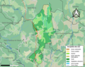
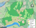
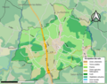
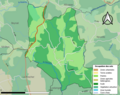
Category:Maps of land use of communes in Corrèze
Jump to navigation
Jump to search
Departments of Metropolitan France: Ain [01] · Aisne [02] · Allier [03] · Alpes-de-Haute-Provence [04] · Hautes-Alpes [05] · Alpes-Maritimes [06] · Ardèche [07] · Ardennes [08] · Ariège [09] · Aube [10] · Aude [11] · Aveyron [12] · Bouches-du-Rhône [13] · Calvados [14] · Cantal [15] · Charente [16] · Charente-Maritime [17] · Cher [18] · Corrèze [19] · Corse-du-Sud [2A]† · Haute-Corse [2B]† · Côte-d’Or [21] · Côtes-d'Armor [22] · Creuse [23] · Dordogne [24] · Doubs [25] · Drôme [26] · Eure [27] · Eure-et-Loir [28] · Finistère [29] · Gard [30] · Haute-Garonne [31] · Gers [32] · Gironde [33] · Hérault [34] · Ille-et-Vilaine [35] · Indre [36] · Indre-et-Loire [37] · Isère [38] · Jura [39] · Landes [40] · Loir-et-Cher [41] · Loire [42] · Haute-Loire [43] · Loire-Atlantique [44] · Loiret [45] · Lot [46] · Lot-et-Garonne [47] · Lozère [48] · Maine-et-Loire [49] · Manche [50] · Marne [51] · Haute-Marne [52] · Mayenne [53] · Meurthe-et-Moselle [54] · Meuse [55] · Morbihan [56] · Moselle [57] · Nièvre [58] · Nord [59] · Oise [60] · Orne [61] · Pas-de-Calais [62] · Puy-de-Dôme [63] · Pyrénées-Atlantiques [64] · Hautes-Pyrénées [65] · Pyrénées-Orientales [66] · Bas-Rhin [67] · Haut-Rhin [68] · departmental district of the Rhône [69] · Rhône [69D]‡ · Metropolis of Lyon [69M]‡ · Haute-Saône [70] · Saône-et-Loire [71] · Sarthe [72] · Savoie [73] · Haute-Savoie [74] · Seine-Maritime [76] · Seine-et-Marne [77] · Yvelines [78] · Deux-Sèvres [79] · Somme [80] · Tarn [81] · Tarn-et-Garonne [82] · Var [83] · Vaucluse [84] · Vendée [85] · Vienne [86] · Haute-Vienne [87] · Vosges [88] · Yonne [89] · Territoire de Belfort [90] · Essonne [91] · Hauts-de-Seine [92] · Seine-Saint-Denis [93] · Val-de-Marne [94] · Val-d'Oise [95]
Media in category "Maps of land use of communes in Corrèze"
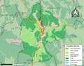
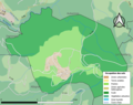
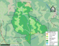
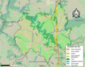
The following 200 files are in this category, out of 245 total.
(previous page) (next page)-
 19001-Affieux-Sols.png 3,270 × 2,598; 2.28 MB
-
 19002-Aix-Sols.png 3,270 × 2,598; 2.81 MB
-
 19003-Albignac-Sols.png 3,270 × 2,598; 1.64 MB
-
 19004-Albussac-Sols.png 3,270 × 2,598; 2.82 MB
-
 19005-Allassac-Sols.png 3,270 × 2,598; 4.25 MB
-
 19006-Alleyrat-Sols.png 3,270 × 2,598; 1.73 MB
-
 19007-Altillac-Sols.png 3,270 × 2,598; 2.73 MB
-
 19008-Ambrugeat-Sols.png 3,270 × 2,598; 2.54 MB
-
 19009-Les Angles-sur-Corrèze-Sols.png 3,270 × 2,598; 1.36 MB
-
 19010-Argentat-sur-Dordogne-Sols.png 3,270 × 2,598; 4.13 MB
-
 19011-Arnac-Pompadour-Sols.png 3,270 × 2,598; 2.17 MB
-
 19012-Astaillac-Sols.png 3,270 × 2,598; 1.85 MB
-
 19013-Aubazines-Sols.png 3,270 × 2,598; 2.26 MB
-
 19014-Auriac-Sols.png 3,270 × 2,598; 2.52 MB
-
 19015-Ayen-Sols.png 3,270 × 2,598; 2.52 MB
-
 19016-Bar-Sols.png 3,270 × 2,598; 2.32 MB
-
 19017-Bassignac-le-Bas-Sols.png 3,270 × 2,598; 1.96 MB
-
 19018-Bassignac-le-Haut-Sols.png 3,270 × 2,598; 1.9 MB
-
 19019-Beaulieu-sur-Dordogne-Sols.png 3,270 × 2,598; 3.43 MB
-
 19020-Beaumont-Sols.png 3,270 × 2,598; 2.03 MB
-
 19021-Bellechassagne-Sols.png 3,270 × 2,598; 1.54 MB
-
 19022-Benayes-Sols.png 3,270 × 2,598; 2.99 MB
-
 19023-Beynat-Sols.png 3,270 × 2,598; 2.7 MB
-
 19024-Beyssac-Sols.png 3,270 × 2,598; 3.18 MB
-
 19025-Beyssenac-Sols.png 3,270 × 2,598; 2.11 MB
-
 19026-Bilhac-Sols.png 3,270 × 2,598; 1.62 MB
-
 19027-Bonnefond-Sols.png 3,270 × 2,598; 2.35 MB
-
 19028-Bort-les-Orgues-Sols.png 3,270 × 2,598; 2.27 MB
-
 19029-Branceilles-Sols.png 3,270 × 2,598; 1.87 MB
-
 19030-Brignac-la-Plaine-Sols.png 3,270 × 2,598; 2.3 MB
-
 19031-Brive-la-Gaillarde-Sols.png 3,270 × 2,598; 6.08 MB
-
 19033-Bugeat-Sols.png 3,270 × 2,598; 2.59 MB
-
 19034-Camps-Saint-Mathurin-Léobazel-Sols.png 3,270 × 2,598; 2.63 MB
-
 19035-Chabrignac-Sols.png 3,270 × 2,598; 2.35 MB
-
 19036-Chamberet-Sols.png 3,270 × 2,598; 3.33 MB
-
 19037-Chamboulive-Sols.png 3,270 × 2,598; 3.36 MB
-
 19038-Chameyrat-Sols.png 3,270 × 2,598; 3.13 MB
-
 19039-Champagnac-la-Noaille-Sols.png 3,270 × 2,598; 2.37 MB
-
 19040-Champagnac-la-Prune-Sols.png 3,270 × 2,598; 1.83 MB
-
 19041-Chanac-les-Mines-Sols.png 3,270 × 2,598; 2.66 MB
-
 19042-Chanteix-Sols.png 3,270 × 2,598; 2.64 MB
-
 19043-La Chapelle-aux-Brocs-Sols.png 3,270 × 2,598; 1.39 MB
-
 19044-La Chapelle-aux-Saints-Sols.png 3,270 × 2,598; 1.58 MB
-
 19045-La Chapelle-Saint-Géraud-Sols.png 3,270 × 2,598; 2.19 MB
-
 19046-Chapelle-Spinasse-Sols.png 3,270 × 2,598; 1.25 MB
-
 19047-Chartrier-Ferrière-Sols.png 3,270 × 2,598; 1.56 MB
-
 19048-Le Chastang-Sols.png 3,270 × 2,598; 1.78 MB
-
 19049-Chasteaux-Sols.png 3,270 × 2,598; 2.62 MB
-
 19050-Chauffour-sur-Vell-Sols.png 3,270 × 2,598; 1.64 MB
-
 19051-Chaumeil-Sols.png 3,270 × 2,598; 2.12 MB
-
 19052-Chavanac-Sols.png 3,270 × 2,598; 1.27 MB
-
 19053-Chaveroche-Sols.png 3,270 × 2,598; 2.69 MB
-
 19054-Chenailler-Mascheix-Sols.png 3,270 × 2,598; 2.15 MB
-
 19055-Chirac-Bellevue-Sols.png 3,270 × 2,598; 2.03 MB
-
 19056-Clergoux-Sols.png 3,270 × 2,598; 1.99 MB
-
 19057-Collonges-la-Rouge-Sols.png 3,270 × 2,598; 2.85 MB
-
 19058-Combressol-Sols.png 3,270 × 2,598; 2.69 MB
-
 19059-Concèze-Sols.png 3,270 × 2,598; 2.49 MB
-
 19060-Condat-sur-Ganaveix-Sols.png 3,270 × 2,598; 2.94 MB
-
 19061-Cornil-Sols.png 3,270 × 2,598; 2.67 MB
-
 19062-Corrèze-Sols.png 3,270 × 2,598; 3.19 MB
-
 19063-Cosnac-Sols.png 3,270 × 2,598; 3.9 MB
-
 19064-Couffy-sur-Sarsonne-Sols.png 3,270 × 2,598; 1.67 MB
-
 19065-Courteix-Sols.png 3,270 × 2,598; 1.38 MB
-
 19066-Cublac-Sols.png 3,270 × 2,598; 2.65 MB
-
 19067-Curemonte-Sols.png 3,270 × 2,598; 1.96 MB
-
 19068-Dampniat-Sols.png 3,270 × 2,598; 2.7 MB
-
 19069-Darazac-Sols.png 3,270 × 2,598; 1.96 MB
-
 19070-Darnets-Sols.png 3,270 × 2,598; 2.56 MB
-
 19071-Davignac-Sols.png 3,270 × 2,598; 2.1 MB
-
 19072-Donzenac-Sols.png 3,270 × 2,598; 3.46 MB
-
 19073-Égletons-Sols.png 3,270 × 2,598; 2.93 MB
-
 19074-L'Église-aux-Bois-Sols.png 3,270 × 2,598; 1.71 MB
-
 19075-Espagnac-Sols.png 3,270 × 2,598; 2.44 MB
-
 19076-Espartignac-Sols.png 3,270 × 2,598; 2.49 MB
-
 19077-Estivals-Sols.png 3,270 × 2,598; 1.17 MB
-
 19078-Estivaux-Sols.png 3,270 × 2,598; 2.37 MB
-
 19079-Eyburie-Sols.png 3,270 × 2,598; 3.1 MB
-
 19080-Eygurande-Sols.png 3,270 × 2,598; 2.53 MB
-
 19081-Eyrein-Sols.png 3,270 × 2,598; 2.39 MB
-
 19082-Favars-Sols.png 3,270 × 2,598; 2.59 MB
-
 19083-Feyt-Sols.png 3,270 × 2,598; 2.46 MB
-
 19084-Forgès-Sols.png 3,270 × 2,598; 2.01 MB
-
 19085-Gimel-les-Cascades-Sols.png 3,270 × 2,598; 2.71 MB
-
 19086-Goulles-Sols.png 3,270 × 2,598; 2.56 MB
-
 19087-Gourdon-Murat-Sols.png 3,270 × 2,598; 1.52 MB
-
 19088-Grandsaigne-Sols.png 3,270 × 2,598; 1.89 MB
-
 19089-Gros-Chastang-Sols.png 3,270 × 2,598; 1.9 MB
-
 19090-Gumond-Sols.png 3,270 × 2,598; 1.63 MB
-
 19091-Hautefage-Sols.png 3,270 × 2,598; 2.59 MB
-
 19092-Le Jardin-Sols.png 3,270 × 2,598; 1.63 MB
-
 19093-Jugeals-Nazareth-Sols.png 3,270 × 2,598; 1.99 MB
-
 19094-Juillac-Sols.png 3,270 × 2,598; 2.35 MB
-
 19095-Lacelle-Sols.png 3,270 × 2,598; 2 MB
-
 19096-Ladignac-sur-Rondelles-Sols.png 3,270 × 2,598; 2.21 MB
-
 19097-Lafage-sur-Sombre-Sols.png 3,270 × 2,598; 2.11 MB
-
 19098-Lagarde-Marc-la-Tour-Sols.png 3,270 × 2,598; 2.56 MB
-
 19099-Lagleygeolle-Sols.png 3,270 × 2,598; 2.2 MB
-
 19100-Lagraulière-Sols.png 3,270 × 2,598; 2.74 MB
-
 19101-Laguenne-sur-Avalouze-Sols.png 3,270 × 2,598; 3.35 MB
-
 19102-Lamazière-Basse-Sols.png 3,270 × 2,598; 3.2 MB
-
 19103-Lamazière-Haute-Sols.png 3,270 × 2,598; 2.03 MB
-
 19104-Lamongerie-Sols.png 3,270 × 2,598; 1.5 MB
-
 19105-Lanteuil-Sols.png 3,270 × 2,598; 2 MB
-
 19106-Lapleau-Sols.png 3,270 × 2,598; 2.46 MB
-
 19107-Larche-Sols.png 3,270 × 2,598; 2.3 MB
-
 19108-Laroche-près-Feyt-Sols.png 3,270 × 2,598; 1.96 MB
-
 19109-Lascaux-Sols.png 3,270 × 2,598; 1.96 MB
-
 19110-Latronche-Sols.png 3,270 × 2,598; 2.14 MB
-
 19111-Laval-sur-Luzège-Sols.png 3,270 × 2,598; 1.77 MB
-
 19112-Lestards-Sols.png 3,270 × 2,598; 2.64 MB
-
 19113-Liginiac-Sols.png 3,270 × 2,598; 2.77 MB
-
 19114-Lignareix-Sols.png 3,270 × 2,598; 2.06 MB
-
 19115-Ligneyrac-Sols.png 3,270 × 2,598; 2.1 MB
-
 19116-Liourdres-Sols.png 3,270 × 2,598; 1.8 MB
-
 19117-Lissac-sur-Couze-Sols.png 3,270 × 2,598; 2.1 MB
-
 19118-Le Lonzac-Sols.png 3,270 × 2,598; 2.26 MB
-
 19119-Lostanges-Sols.png 3,270 × 2,598; 2.29 MB
-
 19120-Louignac-Sols.png 3,270 × 2,598; 1.91 MB
-
 19121-Lubersac-Sols.png 3,270 × 2,598; 3.36 MB
-
 19122-Madranges-Sols.png 3,270 × 2,598; 1.69 MB
-
 19123-Malemort-Sols.png 3,270 × 2,598; 3.83 MB
-
 19124-Mansac-Sols.png 3,270 × 2,598; 2.75 MB
-
 19125-Marcillac-la-Croisille-Sols.png 3,270 × 2,598; 3.03 MB
-
 19126-Marcillac-la-Croze-Sols.png 3,270 × 2,598; 2 MB
-
 19128-Margerides-Sols.png 3,270 × 2,598; 2.05 MB
-
 19129-Masseret-Sols.png 3,270 × 2,598; 1.91 MB
-
 19130-Maussac-Sols.png 3,270 × 2,598; 2.18 MB
-
 19131-Meilhards-Sols.png 3,270 × 2,598; 2.71 MB
-
 19132-Ménoire-Sols.png 3,270 × 2,598; 1.37 MB
-
 19133-Mercœur-Sols.png 3,270 × 2,598; 2.79 MB
-
 19134-Merlines-Sols.png 3,270 × 2,598; 2.02 MB
-
 19135-Mestes-Sols.png 3,270 × 2,598; 1.76 MB
-
 19136-Meymac-Sols.png 3,270 × 2,598; 3.7 MB
-
 19137-Meyrignac-l'Église-Sols.png 3,270 × 2,598; 1.77 MB
-
 19138-Meyssac-Sols.png 3,270 × 2,598; 2.53 MB
-
 19139-Millevaches-Sols.png 3,270 × 2,598; 1.37 MB
-
 19140-Monceaux-sur-Dordogne-Sols.png 3,270 × 2,598; 2.74 MB
-
 19141-Monestier-Merlines-Sols.png 3,270 × 2,598; 1.78 MB
-
 19142-Monestier-Port-Dieu-Sols.png 3,270 × 2,598; 2.2 MB
-
 19143-Montaignac-Saint-Hippolyte-Sols.png 3,270 × 2,598; 2.13 MB
-
 19144-Montgibaud-Sols.png 3,270 × 2,598; 1.65 MB
-
 19145-Moustier-Ventadour-Sols.png 3,270 × 2,598; 2.79 MB
-
 19146-Naves-Sols.png 3,270 × 2,598; 4.06 MB
-
 19147-Nespouls-Sols.png 3,270 × 2,598; 1.94 MB
-
 19148-Neuvic-Sols.png 3,270 × 2,598; 4.45 MB
-
 19149-Neuville-Sols.png 3,270 × 2,598; 2.07 MB
-
 19150-Noailhac-Sols.png 3,270 × 2,598; 2.02 MB
-
 19151-Noailles-Sols.png 3,270 × 2,598; 2.26 MB
-
 19152-Nonards-Sols.png 3,270 × 2,598; 2.48 MB
-
 19153-Objat-Sols.png 3,270 × 2,598; 3.23 MB
-
 19154-Orgnac-sur-Vézère-Sols.png 3,270 × 2,598; 2.34 MB
-
 19155-Orliac-de-Bar-Sols.png 3,270 × 2,598; 2.36 MB
-
 19156-Palazinges-Sols.png 3,270 × 2,598; 1.32 MB
-
 19157-Palisse-Sols.png 3,270 × 2,598; 2.05 MB
-
 19158-Pandrignes-Sols.png 3,270 × 2,598; 1.93 MB
-
 19159-Péret-Bel-Air-Sols.png 3,270 × 2,598; 1.41 MB
-
 19160-Pérols-sur-Vézère-Sols.png 3,270 × 2,598; 2.79 MB
-
 19161-Perpezac-le-Blanc-Sols.png 3,270 × 2,598; 1.95 MB
-
 19162-Perpezac-le-Noir-Sols.png 3,270 × 2,598; 2.6 MB
-
 19163-Le Pescher-Sols.png 3,270 × 2,598; 2.2 MB
-
 19164-Peyrelevade-Sols.png 3,270 × 2,598; 2.98 MB
-
 19165-Peyrissac-Sols.png 3,270 × 2,598; 1.42 MB
-
 19166-Pierrefitte-Sols.png 3,270 × 2,598; 1.45 MB
-
 19167-Confolent-Port-Dieu-Sols.png 3,270 × 2,598; 1.76 MB
-
 19168-Pradines-Sols.png 3,270 × 2,598; 1.71 MB
-
 19169-Puy-d'Arnac-Sols.png 3,270 × 2,598; 2.13 MB
-
 19170-Queyssac-les-Vignes-Sols.png 3,270 × 2,598; 1.77 MB
-
 19171-Reygade-Sols.png 3,270 × 2,598; 1.92 MB
-
 19172-Rilhac-Treignac-Sols.png 3,270 × 2,598; 1.57 MB
-
 19173-Rilhac-Xaintrie-Sols.png 3,270 × 2,598; 2.54 MB
-
 19174-La Roche-Canillac-Sols.png 3,270 × 2,598; 1.36 MB
-
 19175-Roche-le-Peyroux-Sols.png 3,270 × 2,598; 1.49 MB
-
 19177-Rosiers-de-Juillac-Sols.png 3,270 × 2,598; 1.78 MB
-
 19178-Sadroc-Sols.png 3,270 × 2,598; 2.88 MB
-
 19179-Saillac-Sols.png 3,270 × 2,598; 1.87 MB
-
 19180-Saint-Angel-Sols.png 3,270 × 2,598; 3.03 MB
-
 19181-Saint-Augustin-Sols.png 3,270 × 2,598; 3.01 MB
-
 19182-Saint-Aulaire-Sols.png 3,270 × 2,598; 2.43 MB
-
 19184-Saint-Bazile-de-Meyssac-Sols.png 3,270 × 2,598; 1.25 MB
-
 19186-Saint-Bonnet-Elvert-Sols.png 3,270 × 2,598; 2.09 MB
-
 19187-Saint-Bonnet-la-Rivière-Sols.png 3,270 × 2,598; 2.7 MB
-
 19188-Saint-Bonnet-l'Enfantier-Sols.png 3,270 × 2,598; 2.18 MB
-
 19189-Saint-Bonnet-les-Tours-de-Merle-Sols.png 3,270 × 2,598; 1.32 MB
-
 19190-Saint-Bonnet-près-Bort-Sols.png 3,270 × 2,598; 2.48 MB
-
 19191-Saint-Cernin-de-Larche-Sols.png 3,270 × 2,598; 1.69 MB
-
 19192-Saint-Chamant-Sols.png 3,270 × 2,598; 1.85 MB
-
 19193-Saint-Cirgues-la-Loutre-Sols.png 3,270 × 2,598; 2 MB
-
 19194-Saint-Clément-Sols.png 3,270 × 2,598; 3.53 MB
-
 19195-Saint-Cyprien-Sols.png 3,270 × 2,598; 2.28 MB
-
 19196-Saint-Cyr-la-Roche-Sols.png 3,270 × 2,598; 2.34 MB
-
 19198-Saint-Éloy-les-Tuileries-Sols.png 3,270 × 2,598; 1.56 MB
-
 19199-Saint-Étienne-aux-Clos-Sols.png 3,270 × 2,598; 1.98 MB
-
 19200-Saint-Étienne-la-Geneste-Sols.png 3,270 × 2,598; 1.26 MB
-
 19201-Saint-Exupéry-les-Roches-Sols.png 3,270 × 2,598; 2.81 MB
-
 19202-Sainte-Féréole-Sols.png 3,270 × 2,598; 3.66 MB
-
 19203-Sainte-Fortunade-Sols.png 3,270 × 2,598; 4.09 MB
-
 19204-Saint-Fréjoux-Sols.png 3,270 × 2,598; 2.18 MB
-
 19205-Saint-Geniez-ô-Merle-Sols.png 3,270 × 2,598; 2.23 MB
-
 19206-Saint-Germain-Lavolps-Sols.png 3,270 × 2,598; 1.7 MB


Categories:
- Maps of land use of communes in Nouvelle-Aquitaine
- Maps of land use of communes in France by department
- Maps of communes in Corrèze
- Maps of forests in Corrèze
- Maps of meadows in Corrèze
- Maps of arable land in Corrèze
- Maps of heterogenic agricultural zones in Corrèze
- Maps of urbanisation in Corrèze
- Maps of land use in Corrèze