Category:Maps of islands of Papua New Guinea
Jump to navigation
Jump to search
Subcategories
This category has only the following subcategory.
M
Media in category "Maps of islands of Papua New Guinea"
The following 21 files are in this category, out of 21 total.
-
 1957 Map of Baluan Island.png 3,818 × 3,093; 30.15 MB
-
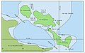 Archipel d'Entrecasteaux.jpg 5,000 × 3,154; 403 KB
-
 Carteret Map.jpg 1,240 × 904; 129 KB
-
 Dyaul reef zone.png 992 × 527; 65 KB
-
 Engineer Group Map 250.png 1,143 × 553; 1.04 MB
-
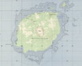
 GoodenoughIslandTopography.png 1,398 × 1,276; 312 KB
-
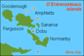 Karta PG D´Entrecasteaux isl.PNG 300 × 200; 4 KB
-
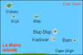 Karta PG LeMaire isl.PNG 300 × 200; 3 KB
-
 Karta PG Louisiade isl.PNG 300 × 200; 4 KB
-
 Karta PG Marshall Bennett isl.png 200 × 300; 3 KB
-
 Karta PG Trobriand isl.PNG 300 × 200; 4 KB
-
 Karta PG Woodlark isl.png 300 × 200; 5 KB
-
 Normanby Island (Papua New Guinea) Topography.png 2,031 × 1,520; 390 KB
-
 Pinipel-CS-1813.jpg 4,051 × 5,309; 2.33 MB
-
 Schouten Islands (Papua New Guinea) Topography.png 1,859 × 1,295; 474 KB
-
 Schouten Islands (Papua New Guinea) txu-oclc-6552576-sa55-13.jpg 5,000 × 3,769; 2.67 MB
-
 Siassi Islands Relief.jpg 450 × 477; 26 KB
-
 Tanga Islands nla.obj-233138948-1 (cropped).jpg 1,186 × 976; 692 KB
-
 Tanga Islands nla.obj-233138948-1.jpg 5,000 × 4,148; 10.61 MB
-
 Trobriand be.png 1,000 × 530; 54 KB
-
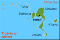
 Trobriand.png 671 × 401; 36 KB


_Topography.png)

_Topography.png)
_txu-oclc-6552576-sa55-13.jpg)

.jpg)


