Category:Maps of hromadas in Ternopil Oblast
Jump to navigation
Jump to search
Regions of Ukraine:
Oblasts: Ternopil · – Cities: – Autonomous Republic:
Oblasts: Ternopil · – Cities: – Autonomous Republic:
| NO WIKIDATA ID FOUND! Search for Maps of hromadas in Ternopil Oblast on Wikidata | |
| Upload media |
Subcategories
This category has the following 16 subcategories, out of 16 total.
B
K
M
N
P
T
Z
Media in category "Maps of hromadas in Ternopil Oblast"
The following 6 files are in this category, out of 6 total.
-
 Ternopil Oblast 2020 subdivisions.jpg 1,100 × 1,556; 147 KB
-
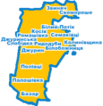 Білобожницька сільська громада, Мапа.png 232 × 241; 19 KB
-
 Заводська селищна громада, Мапа.png 1,191 × 1,447; 103 KB
-
 Колиндянська сільська громада, Мапа.png 381 × 435; 20 KB
-
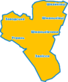
 Нагірянська громада, Мапа.png 550 × 457; 35 KB
-
 Чортківська міська громада, Мапа.png 356 × 380; 22 KB


