Category:Maps of former colonies of the United Kingdom in North America
Jump to navigation
Jump to search
Subcategories
This category has the following 6 subcategories, out of 6 total.
Media in category "Maps of former colonies of the United Kingdom in North America"
The following 6 files are in this category, out of 6 total.
-
 America 1794.png 988 × 1,270; 297 KB
-
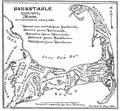 Barnstable county 1890.PNG 403 × 374; 140 KB
-
 British Windward Islands.gif 1,346 × 1,156; 70 KB
-
 Colonias europea en América siglo XVI-XVIII.png 536 × 618; 11 KB
-
 Colonization of the Americas 1750 id.PNG 470 × 623; 17 KB
-
 West Indies and Central America.jpg 3,392 × 2,724; 3.92 MB


