Category:Maps of districts of Sindh
Jump to navigation
Jump to search
Provinces of Pakistan: Khyber Pakhtunkhwa · Punjab · Sindh ·
Territories: Azad Kashmir · Gilgit-Baltistan ·
Territories: Azad Kashmir · Gilgit-Baltistan ·
Subcategories
This category has the following 7 subcategories, out of 7 total.
Media in category "Maps of districts of Sindh"
The following 28 files are in this category, out of 28 total.
-
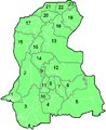
 Sindh District.svg 344 × 425; 29 KB
-
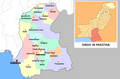
 Pakistan Sindh location map.PNG 499 × 474; 34 KB
-
 Sindh administrative1.png 499 × 474; 22 KB
-
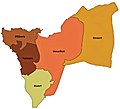
 Sindh administrative2.png 375 × 458; 19 KB
-
 Sindh districts Pakistan.PNG 600 × 466; 59 KB
-
 Sindh Districts.svg 817 × 1,000; 39 KB
-
 Sindh-districts.png 375 × 458; 18 KB
-
 Sindh Dist Names.svg 3,399 × 4,166; 539 KB
-
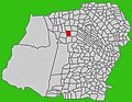
 Area Map of Mirpurkhas.png 500 × 370; 10 KB
-
 Badin District.jpg 799 × 982; 172 KB
-
 Bagodero Kamber.jpg 840 × 653; 180 KB
-
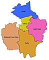
 Dadu District.jpg 692 × 1,026; 141 KB
-
 Dadu Taluka.jpg 761 × 1,148; 222 KB
-
 Districts of Sindh.jpg 889 × 965; 349 KB
-
 Hyderabad Numbered Map.png 400 × 300; 18 KB
-
 Johi Taluka.jpg 697 × 1,017; 201 KB
-
 Kamber Taluka.jpg 934 × 821; 110 KB
-
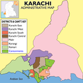 Karachi admin.PNG 2,472 × 2,480; 927 KB
-
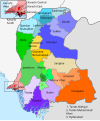
 Karachi map.svg 8,229 × 8,647; 313 KB
-
 Mehar Taluka.jpg 681 × 1,050; 201 KB
-
 Pakistan Sindh districts map.svg 858 × 1,030; 558 KB
-
 Sindh-Map.PNG 1,400 × 1,864; 514 KB
-
 Sindh-Pakistan-Map.png 719 × 474; 89 KB
-
 Taluka KN Shah.jpg 678 × 988; 104 KB
-
 Taluka Mirpur Sakro.jpg 661 × 903; 75 KB
-
 Tando Allahyar District.jpg 652 × 961; 135 KB
-
 Thatta Talku.jpg 679 × 923; 70 KB
-
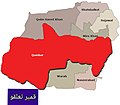
 Umerkot District.jpg 1,028 × 933; 251 KB


