Category:Maps of districts of Ethiopia
Jump to navigation
Jump to search
Media in category "Maps of districts of Ethiopia"
The following 37 files are in this category, out of 37 total.
-
-
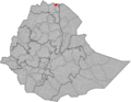
 Adwa.png 1,308 × 1,013; 37 KB
-
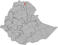
 Ahferom.png 1,308 × 1,013; 37 KB
-
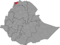
 Alaje.png 1,308 × 1,013; 37 KB
-
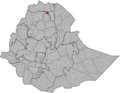
 Alamata.png 1,308 × 1,013; 37 KB
-
 Asgede Tsimbila.png 1,308 × 1,013; 37 KB
-
 Atsbi Wenberta.png 1,308 × 1,013; 37 KB
-
 Endamehoni.png 1,308 × 1,013; 37 KB
-
 Enderta.png 1,308 × 1,013; 37 KB
-
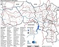
 Ethiopia administrative boundaries.png 5,000 × 3,819; 2.56 MB
-
 Ethiopia administrative boundaries.svg 800 × 611; 11.29 MB
-
 Ethiopia Input Administrative Boundaries (5457149891).jpg 2,525 × 3,209; 710 KB
-
 Ganta Afeshum.png 1,308 × 1,013; 37 KB
-
 Gulomekeda.png 1,308 × 1,013; 37 KB
-
 Hawzen.png 1,308 × 1,013; 37 KB
-
 Hintalo Wejirat.png 1,308 × 1,013; 37 KB
-
 Irob.png 5,000 × 3,819; 2.56 MB
-
 Kafta Humera.png 5,000 × 3,819; 2.56 MB
-
 Kelete Awelallo.png 1,308 × 1,013; 37 KB
-
 Kola Temben.png 1,308 × 1,013; 37 KB
-
 La'ilay Adiyabo.png 1,308 × 1,013; 37 KB
-
 Laelay Maychew.png 1,308 × 1,013; 37 KB
-
 Map of Dirashe special woreda.png 5,000 × 3,819; 1.28 MB
-
 Medebay Zana.png 1,308 × 1,013; 37 KB
-
 Mereb Leke.png 1,308 × 1,013; 37 KB
-
 Naeder Adet.png 1,308 × 1,013; 37 KB
-
 Ofla.png 1,308 × 1,013; 37 KB
-
 Raya Azebo.png 1,308 × 1,013; 37 KB
-
 Saesie Tsaedaemba.png 1,308 × 1,013; 37 KB
-
 Saharti Samre.png 1,308 × 1,013; 37 KB
-
 Tahtay Koraro.png 1,308 × 1,013; 37 KB
-
 Tahtay Maychew.png 1,308 × 1,013; 37 KB
-
 Tanqua Abergele.png 1,308 × 1,013; 37 KB
-
 Tsegede.png 5,000 × 3,819; 2.56 MB
-
 Tselemti.png 1,308 × 1,013; 37 KB
-
 Welkait.png 5,000 × 3,819; 2.56 MB
-
 Werei Leke.png 1,308 × 1,013; 37 KB
_level,_as_implemented_in_January_2020.jpg)


.jpg)


