Category:Maps of districts of Afghanistan
Jump to navigation
Jump to search
Subcategories
This category has the following 5 subcategories, out of 5 total.
B
- Badakhshan Districts Maps (43 F)
- Badghis Districts Maps (8 F)
K
- Kabul Districts Maps (13 F)
- Kunduz District Maps (2 F)
T
- Takhar District Maps (17 F)
Media in category "Maps of districts of Afghanistan"
The following 54 files are in this category, out of 54 total.
-
 Afghanistan Badakhshan numbered gray.PNG 1,056 × 816; 28 KB
-
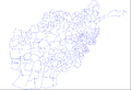
 Afghanistan District Map 399 set.svg 800 × 506; 2.13 MB
-
 Afghanistan District-pus.png 1,223 × 989; 95 KB
-
 Afghanistan District.png 1,223 × 989; 95 KB
-
 Afghanistan districts.png 1,281 × 878; 35 KB
-
 Badakhshan districts Pashto.png 1,056 × 816; 57 KB
-
 Badakhshan districts.png 961 × 658; 27 KB
-
 Badghis districts.png 960 × 658; 16 KB
-
 Distrito de Puli Khumri.PNG 1,281 × 878; 28 KB
-
 Bamyan districts.png 960 × 658; 15 KB
-
 Shahidan district.png 312 × 567; 121 KB
-
 Blank map of Afghanistan districts.svg 910 × 670; 700 KB
-
 Daykundi districts.png 960 × 658; 14 KB
-
 Farah districts.png 960 × 658; 18 KB
-
 Faryab districts Pashto.png 1,056 × 816; 61 KB
-
 Faryab districts.png 960 × 658; 30 KB
-
 Ghazni districts.png 960 × 658; 34 KB
-
 Ghazni Map (399 set).svg 248 × 239; 190 KB
-
 Ghor districts.png 960 × 658; 17 KB
-
 Helmand districts.png 1,000 × 763; 32 KB
-
 Herat districts.png 1,000 × 763; 34 KB
-
 Jowzjan districts Pashto.png 1,056 × 816; 56 KB
-
 Jowzjan districts.png 1,000 × 763; 18 KB
-
 Kabul districts.png 1,000 × 763; 31 KB
-
 Kabul province topographic map.png 1,491 × 1,045; 2.64 MB
-
 Kandahar districts.png 1,000 × 763; 30 KB
-
 Kapisa districts.png 1,000 × 763; 17 KB
-
 Karte Provinz Nangarhar.svg 916 × 581; 478 KB
-
 Khost districts.png 1,000 × 763; 30 KB
-
 Konar districts.png 1,000 × 763; 19 KB
-
 Kunduz districts Pashto.png 1,056 × 816; 56 KB
-
 Kunduz districts.png 1,000 × 763; 18 KB
-
 Laghman districts.png 1,000 × 763; 17 KB
-
 Lowgar districts.png 1,000 × 763; 17 KB
-
 Map Nangarhar Province.svg 916 × 581; 476 KB
-
 Map of Afghanistan, Districts and Provinces.svg 750 × 475; 2.57 MB
-
 Map of Khwaja Ghar.png 1,388 × 1,388; 2.62 MB
-
 Nangarhar districts Pashto.png 1,056 × 816; 53 KB
-
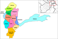
 Nangarhar districts.png 1,000 × 763; 43 KB
-
 Nimroz map .jpg 800 × 600; 151 KB
-
 Nimruz districts.png 1,000 × 762; 17 KB
-
 Nurestan districts.png 1,000 × 763; 19 KB
-
 Oruzgan districts.png 1,000 × 762; 17 KB
-
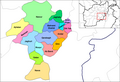
 Paktia districts.png 1,000 × 762; 20 KB
-
 Paktika districts.png 1,000 × 762; 32 KB
-
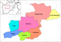
 Panjshir districts.png 1,000 × 762; 14 KB
-
 Parvan districts.png 1,000 × 762; 20 KB
-
 Samangan districts.png 1,000 × 760; 16 KB
-
 Sare Pol districts.png 1,000 × 760; 18 KB
-
 Takhar districts Pashto.png 1,056 × 816; 59 KB
-
 Takhar districts.png 1,000 × 760; 20 KB
-
 Wardak districts.png 1,000 × 760; 18 KB
-
 Zabul districts.png 1,000 × 760; 19 KB
-
 Zarghun-Shahr-District-after-2004.png 992 × 823; 40 KB


.svg)


