Category:Maps of counties of Georgia (U.S. state)
Jump to navigation
Jump to search
States of the United States: Alabama · Alaska · Arizona · Arkansas · California · Colorado · Connecticut · Delaware · Florida · Georgia · Hawaii · Idaho · Illinois · Indiana · Iowa · Kansas · Kentucky · Louisiana · Maine · Maryland · Massachusetts · Michigan · Minnesota · Mississippi · Missouri · Montana · Nebraska · Nevada · New Hampshire · New Jersey · New Mexico · New York · North Carolina · North Dakota · Ohio · Oklahoma · Oregon · Pennsylvania · Rhode Island · South Carolina · South Dakota · Tennessee · Texas · Utah · Vermont · Virginia · Washington · West Virginia · Wisconsin · Wyoming
Counties of Georgia: Appling · Atkinson · Bacon · Baker · Baldwin · Banks · Barrow · Bartow · Ben Hill · Berrien · Bleckley · Brantley · Brooks · Bryan · Bulloch · Burke · Butts · Calhoun · Camden · Campbell · Candler · Carroll · Catoosa · Charlton · Chatham · Chattooga · Cherokee · Clay · Clayton · Clinch · Cobb · Coffee · Colquitt · Columbia · Cook · Coweta · Crawford · Crisp · Dade · Dawson · Decatur · DeKalb · Dodge · Dooly · Dougherty · Douglas · Early · Effingham · Elbert · Emanuel · Evans · Fannin · Fayette · Floyd · Forsyth · Franklin · Fulton · Gilmer · Glascock · Glynn · Gordon · Grady · Greene · Gwinnett · Habersham · Hall · Hancock · Haralson · Harris · Hart · Heard · Henry · Houston · Irwin · Jackson · Jasper · Jeff Davis · Jefferson · Jenkins · Johnson · Jones · Lamar · Lanier · Laurens · Lee · Liberty · Lincoln · Long · Lowndes · Lumpkin · Macon · Madison · Marion · McDuffie · McIntosh · Meriwether · Miller · Milton · Mitchell · Monroe · Montgomery · Morgan · Murray · Newton · Oconee · Oglethorpe · Paulding · Peach · Pickens · Pierce · Pike · Polk · Pulaski · Putnam · Rabun · Randolph · Rockdale · Schley · Screven · Seminole · Spalding · Stephens · Stewart · Sumter · Talbot · Taliaferro · Tattnall · Taylor · Telfair · Terrell · Thomas · Tift · Toombs · Towns · Treutlen · Troup · Turner · Twiggs · Union · Upson · Walker · Walton · Ware · Warren · Washington · Wayne · Wheeler · White · Whitfield · Wilcox · Wilkes · Wilkinson · Worth
City-counties: Athens–Clarke · Augusta–Richmond · Columbus–Muscogee · Cusseta–Chattahoochee · Georgetown–Quitman · Macon–Bibb · Preston–Webster · Statenville–Echols
City-counties: Athens–Clarke · Augusta–Richmond · Columbus–Muscogee · Cusseta–Chattahoochee · Georgetown–Quitman · Macon–Bibb · Preston–Webster · Statenville–Echols
Subcategories
This category has the following 162 subcategories, out of 162 total.
A
B
- Maps of Banks County, Georgia (12 F)
- Maps of Barrow County, Georgia (12 F)
- Maps of Bartow County, Georgia (25 F)
- Maps of Bibb County, Georgia (8 F)
- Maps of Bulloch County, Georgia (10 F)
- Maps of Burke County, Georgia (17 F)
C
- Maps of Camden County, Georgia (14 F)
- Maps of Catoosa County, Georgia (14 F)
- Maps of Chatham County, Georgia (45 F)
- Maps of Cherokee County, Georgia (17 F)
- Maps of Clay County, Georgia (5 F)
- Maps of Clayton County, Georgia (18 F)
- Maps of Cobb County, Georgia (31 F)
- Maps of Colquitt County, Georgia (14 F)
- Maps of Columbia County, Georgia (11 F)
- Maps of Cook County, Georgia (8 F)
- Maps of Coweta County, Georgia (17 F)
D
- Maps of Dade County, Georgia (1 F)
- Maps of Dodge County, Georgia (13 F)
- Maps of Dooly County, Georgia (11 F)
E
- Maps of Early County, Georgia (12 F)
- Maps of Emanuel County, Georgia (17 F)
- Maps of Evans County, Georgia (10 F)
F
- Maps of Fayette County, Georgia (11 F)
- Maps of Franklin County, Georgia (14 F)
G
- Maps of Glascock County, Georgia (10 F)
- Maps of Greene County, Georgia (10 F)
- Maps of Gwinnett County, Georgia (42 F)
H
- Maps of Hall County, Georgia (11 F)
- Maps of Hart County, Georgia (14 F)
- Maps of Henry County, Georgia (12 F)
- Maps of Houston County, Georgia (10 F)
I
J
- Maps of Jackson County, Georgia (14 F)
L
- Maps of Laurens County, Georgia (10 F)
- Maps of Lee County, Georgia (2 F)
- Maps of Liberty County, Georgia (11 F)
- Maps of Long County, Georgia (5 F)
M
- Maps of Madison County, Georgia (12 F)
N
O
P
- Maps of Paulding County, Georgia (11 F)
- Maps of Pike County, Georgia (13 F)
- Maps of Polk County, Georgia (9 F)
Q
R
- Maps of Rabun County, Georgia (12 F)
S
- Maps of Screven County, Georgia (12 F)
- Maps of Spalding County, Georgia (12 F)
- Maps of Stephens County, Georgia (15 F)
- Maps of Sumter County, Georgia (11 F)
T
- Maps of Tattnall County, Georgia (12 F)
- Maps of Telfair County, Georgia (13 F)
- Maps of Thomas County, Georgia (13 F)
- Maps of Tift County, Georgia (9 F)
U
W
- Maps of Walker County, Georgia (19 F)
- Maps of Walton County, Georgia (22 F)
- Maps of Ware County, Georgia (5 F)
- Maps of Wilcox County, Georgia (10 F)
Media in category "Maps of counties of Georgia (U.S. state)"
The following 11 files are in this category, out of 11 total.
-

-
 Blank map subdivisions Georgia.svg 99 × 103; 60 KB
-
 Bluega.png 517 × 599; 129 KB
-
 CampbellCountyGeorgia1895Map.jpg 500 × 313; 61 KB
-
 Georgia-counties-map.gif 747 × 875; 90 KB
-
 Georgia; county subdivisions, census county divisions and places. 1970. LOC gm72003036.jpg 12,048 × 10,157; 8.36 MB
-
 Georgia; county subdivisions, census county divisions and places. 1970. LOC gm72003036.tif 12,048 × 10,157; 350.11 MB
-
 GeorgiaWaterfallCounties.jpg 1,671 × 2,029; 802 KB
-
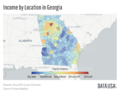 Map of Georgia Median Income by County.png 1,124 × 882; 361 KB
-
 Northwest Georgia.png 2,536 × 2,976; 688 KB
-
 Tennessee and Georgia.png 749 × 638; 104 KB


