Category:Maps of continents
Jump to navigation
Jump to search
Maps of continents.

Subcategories
This category has the following 6 subcategories, out of 6 total.
Media in category "Maps of continents"
The following 18 files are in this category, out of 18 total.
-
 1741 maps of Europe, Asia, Africa and America showing the distribution of languages.jpg 3,910 × 3,507; 2.16 MB
-
 1783 map of the world showing the distribution of mammals.jpg 8,386 × 6,182; 8.43 MB
-

-
 Afro-eurasia globe-INALCO.svg 797 × 795; 489 KB
-
 Carte du monde de Fuller reconfigurée et redessinée.jpg 3,506 × 2,549; 448 KB
-
 Continenti con i confini degli stati.png 1,488 × 755; 49 KB
-
 Continenti numerati.gif 923 × 437; 43 KB
-
 Continents by population.png 6,460 × 3,403; 1.21 MB
-
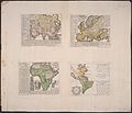 Hensel Polyglot, Maps of the Continents 1741 Cornell CUL PJM 1022 01.jpg 6,333 × 5,440; 4.29 MB
-
 Map of the world 2022.jpg 659 × 465; 48 KB
-
 Map of the World.jpg 5,511 × 2,935; 4.71 MB
-
 Mapa Ficha de pueblo antiguo colores.png 1,354 × 630; 31 KB
-
 MFM Terzisferi bis.png 1,573 × 774; 250 KB
-
 Persian map of the oceans, from a book by Mohammad Safi.jpg 1,844 × 1,044; 432 KB
-
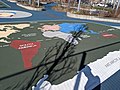
 Playground map, western hemisphere.jpg 4,032 × 3,024; 363 KB
-
 Playground world map.jpg 4,032 × 3,024; 624 KB
-
 Terzisferi.png 1,573 × 774; 249 KB
-
 World Factbook (1990) World.jpg 541 × 394; 91 KB


.jpg)


_World.jpg)