Category:Maps of circles of the canton of Graubünden to 2014
Jump to navigation
Jump to search
Media in category "Maps of circles of the canton of Graubünden to 2014"
The following 21 files are in this category, out of 21 total.
-
 Karte Kreis Alvaschein 2011.png 1,771 × 1,332; 492 KB
-
 Karte Kreis Belfort 2011.png 1,771 × 1,416; 507 KB
-
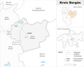 Karte Kreis Bergün 2011.png 1,771 × 1,413; 466 KB
-
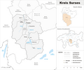 Karte Kreis Surses 2011.png 1,771 × 1,478; 581 KB
-
 Karte Kreis Avers 2011.png 1,771 × 1,435; 418 KB
-
 Karte Kreis Domleschg 2011.png 1,771 × 1,521; 567 KB
-
 Karte Kreis Rheinwald 2011.png 1,771 × 1,200; 413 KB
-
 Karte Kreis Schams 2011.png 1,771 × 1,374; 562 KB
-
 Karte Kreis Thusis 2011.png 1,771 × 1,374; 439 KB
-
 Karte Kreis Ramosch 2013.png 1,771 × 1,554; 473 KB
-
 Karte Kreis Suot Tasna 2013.png 1,771 × 1,384; 493 KB
-
 Karte Kreis Sur Tasna 2013.png 1,771 × 1,383; 544 KB
-
 Karte Kreis Val Müstair 2013.png 1,771 × 1,286; 381 KB
-
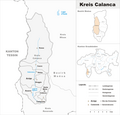 Karte Kreis Calanca 2011.png 1,476 × 1,410; 441 KB
-
 Karte Kreis Mesocco 2011.png 1,476 × 1,410; 448 KB
-
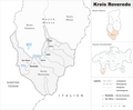 Karte Kreis Roveredo 2011.png 1,771 × 1,456; 516 KB
-
 Karte Kreis Disentis 2014.png 1,476 × 1,070; 422 KB
-
 Karte Kreis Ilanz 2014.png 1,476 × 1,236; 445 KB
-
 Karte Kreis Lugnez 2014.png 1,476 × 1,202; 446 KB
-
 Karte Kreis Ruis 2014.png 1,476 × 1,198; 398 KB
-
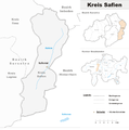 Karte Kreis Safien 2014.png 1,476 × 1,484; 426 KB


