Category:Maps of Ven (Oresund)
Jump to navigation
Jump to search
Subcategories
This category has only the following subcategory.
Media in category "Maps of Ven (Oresund)"
The following 8 files are in this category, out of 8 total.
-

-
 Amager i Sund ubt 1 DA.png 237 × 345; 59 KB
-
 Fotothek df tg 0005703 Geographie ^ Karte ^ Insel.jpg 557 × 820; 266 KB
-
 Map of Hven from copper etching of Blaeu Atlas 1663.jpg 6,304 × 4,939; 19.49 MB
-
 Print, book-illustration, map (BM 1870,0709.559).jpg 629 × 550; 129 KB
-
 Tycho Brahe 0114.png 1,924 × 1,860; 1.63 MB
-
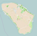 Ven-OSM.PNG 2,016 × 1,948; 713 KB
-
 Öen Hwen.jpg 4,388 × 5,174; 2.25 MB
.jpg)


.jpg)


