<nowiki>Category:Maps of Västerbotten County; Kategori:Kartor över Västerbottens län; categoría de Wikimedia; kategori Wikimedia; Wikimedia category; د ويکيمېډيا وېشنيزه; Vikimedya kategorisi; ویکیمیڈیا زمرہ; kategória projektov Wikimedia; категорія проєкту Вікімедіа; 维基媒体分类; Wikimedia-Kategorie; ৱিকিমিডিয়া শ্ৰেণী; Викимедиина категорија; Wikimedia-Kategorie; विकिपीडिया:श्रेणी; page de catégorie de Wikimedia; kategorija na Wikimediji; विकिपीडिया वर्ग; категорија на Викимедији; Wikimedia-Kategorie; Wikimedia-kategori; kategori Wikimédia; تصنيف ويكيميديا; pajenn rummata eus Wikimedia; Wikimedia:ကဏ္ဍခွဲခြင်း; 維基媒體分類; Wikimedia категориясы; categoría de Wikimedia; Wikimedia-categorie; Викимедиа категорияһы; tudalen categori Wikimedia; Viciméid catagóir; Վիքիմեդիայի նախագծի կատեգորիա; 维基媒体分类; Wikimedia-kategory; ვიკიპედია:კატეგორიზაცია; ウィキメディアのカテゴリ; categoria Wikimedia; تصنيف بتاع ويكيميديا; විකිමීඩියා ප්රභේද පිටුව; categoria Vicimediorum; Vikipidiya:Shopni; Wikimedia-luokka; Wikimedia category; guruhi Vikimedia; катэгорыя ў праекце Вікімэдыя; Викимедиа проектындагы төркем; catigurìa di nu pruggettu Wikimedia; หน้าหมวดหมู่วิกิมีเดีย; Wikimedia:Kategorija; Wikimedia-Kategorie; Wikimedia:Klassys; категория на Уикимедия; categorie a unui proiect Wikimedia; 維基媒體分類; Wikimedia-kategori; kawan Wikimèdia; гурӯҳи Викимедиа; 위키미디어 분류; Wikimedia-bólkur; kategorio en Vikimedio; kategori Wikimedia; Wikimedia:Ronnaghys; উইকিমিডিয়া বিষয়শ্রেণী; kategori Wikimedia; 维基媒体分类; וויקימעדיע קאַטעגאָריע; kategorija w projektach Wikimedije; thể loại Wikimedia; Wikimedia projekta kategorija; Wikimedia-kategorie; categoria de um projeto da Wikimedia; 维基媒体分类; категорияд Ангилал; Wikimedia-kategori; kategori Wikimedia; پۆلی ویکیمیدیا; Wikimedia category; Vikimédia ñemohenda; Wikimédia-kategória; વિકિપીડિયા શ્રેણી; Wikimediako kategoria; категория в проекте Викимедиа; Wikimedia-Kategorie; Kategoriya ning Wikimedia; Wikimedia-kategorie; Wîkîmediya:Kategorî; विकिमिडिया श्रेणी; Wikimedia-Kategorie; קטגוריה במיזמי ויקימדיה; Викимедиа проектындагы төркем; κατηγορία εγχειρημάτων Wikimedia; 維基媒體分類; विकिमिडिया श्रेणी; Wikimedia-kategoriija; гурӯҳи Викимедиа; 維基媒體分類; jamii ya Wikimedia; Wikimedia-categorie; categoria di un progetto Wikimedia; Wikimedia-Kategorie; Wikimedia category; விக்கிமீடியப் பகுப்பு; Wikimedia kategooria; categurìa 'e nu pruggette Wikimedia; Wikimedia-kategori; Wikimedia proyektındağı törkem; катэгорыя ў праекце Вікімедыя; ẹ̀ka Wikimedia; 維基媒體分類; categoria de um projeto da Wikimedia; kategorie na projektech Wikimedia; kategorija na Wikimediji; tumbung Wikimedia; ردهٔ ویکیپدیا; kategorija Wikimedie; kategorya ng Wikimedia; kategoria ti Wikimedia; Wikimedia-Kategorie; kategori Wikimedia; kategoria w projekcie Wikimedia; വിക്കിമീഡിയ വർഗ്ഗം; Wikimedia-categorie; kategori Wikimedia; categoria de Wikimedia; زمرو:وڪيپيڊيا زمرا بندي; categoría de Wikimedia; categoría de Wikimedia; kategori e Wikimedias; 维基媒体分类; विकिमीडिया श्रेणी</nowiki>
Subcategories
This category has the following 4 subcategories, out of 4 total.


 SverigesLän2007Västerbotten.svg 287 × 606; 74 KB
 AC1952.png 842 × 774; 25 KB
 AC1952text.png 842 × 774; 30 KB
 Karta över Västerbotten och Svenska Lappmarken 1796.jpg 3,000 × 2,700; 5.21 MB
 Kartan med AC-nets regionala nät.tif 4,000 × 2,250; 34.33 MB
 Svcmap vasterbotten.png 192 × 400; 8 KB
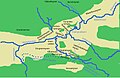 MapOfGrena Storuman.jpg 739 × 479; 59 KB
 Municipalities in Västerbotten County blank.png 773 × 500; 90 KB
 Old provinces westbotn.png 684 × 728; 106 KB
 Rodabygden-wiki-map.svg 540 × 618; 228 KB
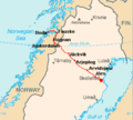 Silvervägen.png 326 × 294; 16 KB
 Utsjocki Charta öfwer twisten mellan Swerige och Norje 1747 1748.svg 4,143 × 2,108; 294 KB
 Valkrets landsting vasterbotten.png 524 × 408; 15 KB
 Västerbotten County (constituency).png 271 × 638; 51 KB
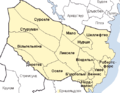 Västerbotten County - UK - Лен Вестерботтен.png 524 × 408; 9 KB
 Västerbotten County.png 524 × 408; 9 KB
 Västerbottens län och svenska lappmarken 1796.svg 2,683 × 2,489; 578 KB


.png)


