Category:Maps of Tikrit
Jump to navigation
Jump to search
Media in category "Maps of Tikrit"
The following 9 files are in this category, out of 9 total.
-
 Map of Tikrit air bases.jpg 520 × 1,127; 162 KB
-
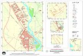
 OSM of Tikrit in Iraq.png 2,254 × 1,928; 2.46 MB
-
 Tikrit (c 2004).jpg 14,609 × 9,912; 88.93 MB
-
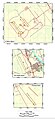
 Tikrit 2003 Ar.jpg 3,977 × 2,689; 3.84 MB
-
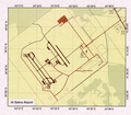 Tikrit Al Sahra Airfield (c 2004).png 3,737 × 3,258; 24.27 MB
-
 Tikrit City (c 2004).jpg 7,639 × 9,746; 51.95 MB
-
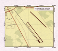 Tikrit East Airport (c 2004).png 2,376 × 2,092; 9.43 MB
-
 Tikrit Map.jpg 3,977 × 2,689; 1.42 MB
-
 Tikrit South Airport (c 2004).png 2,751 × 2,318; 12.9 MB


.jpg)

.png)
.jpg)
.png)

.png)