Category:Maps of Tibet (1912–1951)
Jump to navigation
Jump to search
Subcategories
This category has only the following subcategory.
O
- Old maps of Tibet (1912–1951) (29 F)
Media in category "Maps of Tibet (1912–1951)"
The following 9 files are in this category, out of 9 total.
-
 1949 PRC map.png 728 × 593; 142 KB
-

-
 National Geographic Map of Indian Subcontinent.jpg 2,060 × 1,700; 1.1 MB
-
-
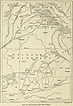
 Simla Convention borders in Kham.jpg 2,877 × 2,061; 1.38 MB
-
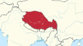
 Tibet 1940.png 1,000 × 1,000; 292 KB
-
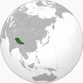
 Tibet state in its region (claims).svg 450 × 253; 2.21 MB
-
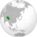
 Tibet state in its region.svg 450 × 253; 2.18 MB
-
 Tibet, World War II.svg 600 × 600; 668 KB


_-_Getty_Research_Institute_(IA_rajputpaintingbe01coom)_(page_22_crop).jpg)


.svg)

