Category:Maps of Tarnopol Voivodeship
Jump to navigation
Jump to search
Wikimedia category | |||||
| Upload media | |||||
| Instance of | |||||
|---|---|---|---|---|---|
| Category combines topics | |||||
| Tarnopol Voivodeship | |||||
former voivodeship of Poland    | |||||
| Instance of |
| ||||
| Location | Second Polish Republic | ||||
| Capital | |||||
| Has part(s) |
| ||||
| Inception |
| ||||
| Dissolved, abolished or demolished date |
| ||||
| Population |
| ||||
| Area |
| ||||
| Replaces | |||||
| Replaced by | |||||
 | |||||
Media in category "Maps of Tarnopol Voivodeship"
The following 28 files are in this category, out of 28 total.
-
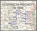 12 DP w 1938.jpg 1,599 × 1,335; 680 KB
-
 PLRUM1919.png 338 × 258; 7 KB
-
 PL–RUM 1919.png 338 × 258; 8 KB
-
 Powiat borszczowski.png 668 × 579; 170 KB
-
 Powiat brodzki.png 481 × 629; 129 KB
-
 Powiat brzeżański.png 522 × 423; 112 KB
-
 Powiat buczacki.png 572 × 491; 159 KB
-
 Powiat czortkowski.png 473 × 394; 129 KB
-
 Powiat kamionecki.png 521 × 520; 124 KB
-
 Powiat kopyczyniecki.png 427 × 524; 148 KB
-
 Powiat podhajecki.png 564 × 435; 132 KB
-
 Powiat przemyślański.png 459 × 537; 128 KB
-
 Powiat radziechowski.png 564 × 488; 120 KB
-
 Powiat skałacki.png 423 × 499; 119 KB
-
 Powiat tarnopolski.jpg 543 × 561; 144 KB
-
 Powiat tarnopolski.png 524 × 551; 191 KB
-
 Powiat trembowelski.png 430 × 420; 111 KB
-
 Powiat zaleszczycki.png 529 × 468; 131 KB
-
 Powiat zbaraski.png 638 × 326; 115 KB
-
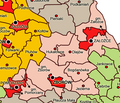 Powiat zborowski.png 587 × 506; 173 KB
-
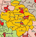 Powiat złoczowski.png 559 × 572; 189 KB
-
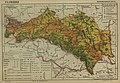
 Tarnopol Voivodeship Administrative Map 1938.png 2,073 × 2,478; 1.48 MB
-
 Tarnopol Voivodeship in the Second Polish Republic (1938).png 1,498 × 1,558; 269 KB
-
 Tarnopol Voivodship 1938.png 390 × 427; 10 KB
-
 Tarnopolskie.gif 391 × 442; 68 KB
-
 Tarnopolskie1939.jpg 391 × 442; 136 KB
-
 Przewodnik po wojewodztwie tarnopolskiem 1936 (111230964).jpg 2,651 × 3,635; 2.2 MB
-
 БСЭ1. Галиция.jpg 1,279 × 887; 583 KB


.png)


.jpg)
