Category:Maps of St. Pölten
Jump to navigation
Jump to search
Wikimedia category | |||||
| Upload media | |||||
| Instance of | |||||
|---|---|---|---|---|---|
| Category combines topics | |||||
| St. Pölten | |||||
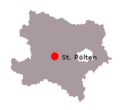
city in Austria, capital of Lower Austria   | |||||
| Pronunciation audio | |||||
| Instance of |
| ||||
| Named after | |||||
| Location | Lower Austria, Austria | ||||
| Head of government |
| ||||
| Population |
| ||||
| Area |
| ||||
| Elevation above sea level |
| ||||
| official website | |||||
 | |||||
Subcategories
This category has only the following subcategory.
O
Media in category "Maps of St. Pölten"
The following 30 files are in this category, out of 30 total.
-
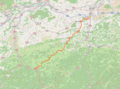 AT-Bundesstrasse39-OSM.png 1,103 × 816; 872 KB
-
 Bistuemer oesterreich st poelten.png 299 × 154; 12 KB
-
 Gerichtsbezirk St. Pölten.svg 998 × 899; 94 KB
-
 Grand Hotel Pittner.svg 1,200 × 1,500; 264 KB
-
 Harlander Karte.svg 878 × 2,251; 1.47 MB
-
 Karte A Noe P 2017.svg 1,050 × 970; 56 KB
-
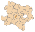 Karte A Noe P.svg 1,050 × 970; 59 KB
-
 Karte Aut Noe P.png 300 × 274; 5 KB
-
 Karte B20 AT.svg 1,920 × 1,760; 450 KB
-
 Karte Traisenbrücken in St. Pölten.svg 1,077 × 1,277; 88 KB
-
 Lagekarte Siebenbründl.svg 1,799 × 1,574; 138 KB
-
 Lageplan HTL St. Pölten.svg 2,633 × 2,300; 431 KB
-
 Lageplan Voithvilla.svg 1,200 × 2,000; 324 KB
-
 Map at sankt pölten.png 400 × 240; 3 KB
-
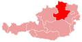
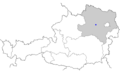
 Sankt Pölten's location in Lower Austria.png 183 × 168; 4 KB
-
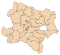
 St Polten location map.png 1,013 × 1,190; 1.69 MB
-
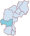
 St.Pölten Karte Harland.svg 1,077 × 1,277; 27 KB
-
 St.Pölten Karte Ochsenburg.svg 1,077 × 1,277; 27 KB
-
 St.Pölten Karte Pottenbrunn.svg 1,077 × 1,277; 27 KB
-
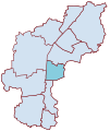
 St.Pölten Karte Radlberg.svg 1,077 × 1,277; 27 KB
-
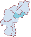
 St.Pölten Karte Ratzersdorf.svg 1,077 × 1,277; 27 KB
-
 St.Pölten Karte Spratzern.svg 1,077 × 1,277; 27 KB
-
 St.Pölten Karte St.Georgen.svg 1,077 × 1,277; 27 KB
-
 St.Pölten Karte St.Pölten.svg 1,077 × 1,277; 20 KB
-
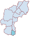
 St.Pölten Karte Stadtteile mit Beschriftung.svg 1,077 × 1,277; 65 KB
-
 St.Pölten Karte Stattersdorf.svg 1,077 × 1,277; 27 KB
-
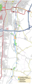
 St.Pölten Karte Verkehr.svg 1,077 × 1,277; 68 KB
-
 St.Pölten Karte Viehofen.svg 1,077 × 1,277; 27 KB
-
 St.Pölten Karte Wagram.svg 1,077 × 1,277; 27 KB
-
 Standorte der HTL St. Pölten.svg 990 × 1,585; 7.04 MB


