Category:Maps of Spanish Morocco
Jump to navigation
Jump to search
Wikimedia category | |||||
| Upload media | |||||
| Instance of | |||||
|---|---|---|---|---|---|
| Category combines topics | |||||
| Spanish protectorate in Morocco | |||||
المغرب أو بوسبير تأسست في كباريات الإسبان يحكمهم ملك مخ.نث .svg)  | |||||
| Instance of |
| ||||
| Location |
| ||||
| Capital | |||||
| Basic form of government |
| ||||
| Official language | |||||
| Currency | |||||
| Inception |
| ||||
| Dissolved, abolished or demolished date |
| ||||
| Religion or worldview | |||||
| Replaces |
| ||||
| Replaced by | |||||
 | |||||
Subcategories
This category has the following 3 subcategories, out of 3 total.
Media in category "Maps of Spanish Morocco"
The following 20 files are in this category, out of 20 total.
-
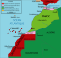
 Cabilas del Protectorado Español de Marruecos-ar.png 1,272 × 631; 189 KB
-

-
 Mapa africa-occicdental-1958.png 1,210 × 1,210; 259 KB
-
 Mapa africa-occicdental-desde-1958.png 1,210 × 1,210; 255 KB
-
 Mapa de África Occicdental hasta 1956.png 1,210 × 1,210; 270 KB
-
 Marrocoprotectorate.png 406 × 388; 63 KB
-
 Marruecos1933.PNG 971 × 755; 46 KB
-
 Morocco Protectorate (hy).png 406 × 388; 25 KB
-
 Morocco Protectorate (rus).png 406 × 388; 45 KB
-
 Flag Map of Spanish Morocco (1913 - 1956).png 1,888 × 924; 13 KB
-
 Flag map of Spanish Morocco (1913 - 1956).png 1,836 × 710; 76 KB
-
 Morocco-spanish-protectorate-1955-a.png 799 × 340; 60 KB
-
 Morocco1879.PNG 431 × 410; 22 KB
-
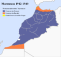 Morocco1912-1940-1945-1956.PNG 1,000 × 951; 92 KB
-
 Morocco3Protection.png 406 × 388; 30 KB
-
 ProtectoradoMarruecos-ar.png 406 × 388; 44 KB
-
 ProtectoradoMarruecos.png 406 × 388; 44 KB
-

-
 Territoire du Rif (ancien protectorat espagnol au nord du Maroc).png 800 × 409; 110 KB
-
 Territorios Españois e Francos en África do Norte.PNG 406 × 388; 47 KB

_combatido_por_Mohamed_El-Khattabi_y_las_tribus_del_Rif).png)


.png)
.png)
.png)


.png)
.png)

.png)