Category:Maps of Seine-Port
Jump to navigation
Jump to search
Wikimedia category | |||||
| Upload media | |||||
| Instance of | |||||
|---|---|---|---|---|---|
| Category combines topics | |||||
| Seine-Port | |||||
commune in Seine-et-Marne, France  .svg)  | |||||
| Instance of | |||||
| Named after |
| ||||
| Location |
| ||||
| Located in or next to body of water | |||||
| Head of government |
| ||||
| Population |
| ||||
| Area |
| ||||
| official website | |||||
 | |||||
Media in category "Maps of Seine-Port"
The following 12 files are in this category, out of 12 total.
-
 77447-Seine-Port - Localisation.png 2,500 × 2,480; 1.42 MB
-
 77447-Seine-Port - Relief-PlanIgn.png 7,015 × 4,960; 11.71 MB
-
 77447-Seine-Port-Cadastre.png 7,015 × 4,960; 8.82 MB
-
 77447-Seine-Port-Géologie.png 7,015 × 4,960; 6.16 MB
-
 77447-Seine-Port-Hydro.png 7,015 × 4,960; 7.17 MB
-
 77447-Seine-Port-Natura 2000.png 7,015 × 4,960; 4.34 MB
-
 77447-Seine-Port-Orthophoto.png 7,015 × 4,960; 5.86 MB
-
 77447-Seine-Port-Sols.png 7,015 × 4,960; 5.05 MB
-
 77447-Seine-Port-ZNIEFF1.png 7,015 × 4,960; 4.58 MB
-
 77447-Seine-Port-ZNIEFF2.png 7,015 × 4,960; 4.55 MB
-
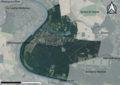
 Map commune FR insee code 77447.png 756 × 605; 47 KB
-
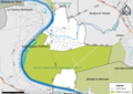
 Périmètre RNR Bruyères de Sainte-Assise rnr207.png 1,198 × 886; 673 KB


