Category:Maps of Scottish Parliament electoral regions
Jump to navigation
Jump to search
The following images are of electoral regions of the Scottish Parliament.
Media in category "Maps of Scottish Parliament electoral regions"
The following 9 files are in this category, out of 9 total.
-
 Central Scotland 1999 (Scottish Parliament electoral region).svg 905 × 1,000; 845 KB
-
 Glasgow 1999 (Scottish Parliament electoral region).svg 905 × 1,000; 846 KB
-
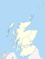
 Highlands and Islands 1999 (Scottish Parliament electoral region).svg 905 × 1,500; 845 KB
-
 Lothians 1999 (Scottish Parliament electoral region).svg 905 × 1,000; 845 KB
-
 Mid Scotland and Fife 1999 (Scottish Parliament electoral region).svg 905 × 1,000; 845 KB
-
 North East Scotland 1999 (Scottish Parliament electoral region).svg 905 × 1,000; 845 KB
-
 Scottish Parliamentary regions 2011.svg 1,023 × 1,345; 2.49 MB
-
 South of Scotland 1999 (Scottish Parliament electoral region).svg 905 × 1,000; 845 KB
-
 West of Scotland 1999 (Scottish Parliament electoral region).svg 905 × 1,000; 845 KB
.svg)
.svg)
.svg)
.svg)
.svg)
.svg)

.svg)
.svg)