Category:Maps of Schweinfurt
Jump to navigation
Jump to search
Wikimedia category | |||||
| Upload media | |||||
| Instance of | |||||
|---|---|---|---|---|---|
| Category combines topics | |||||
| Schweinfurt | |||||
city in the district of Lower Franconia in Bavaria, Germany    .svg) | |||||
| Pronunciation audio | |||||
| Instance of |
| ||||
| Location | Lower Franconia, Bavaria, Germany | ||||
| Street address |
| ||||
| Head of government |
| ||||
| Inception |
| ||||
| Population |
| ||||
| Area |
| ||||
| Elevation above sea level |
| ||||
| Different from | |||||
| official website | |||||
 | |||||
Media in category "Maps of Schweinfurt"
The following 37 files are in this category, out of 37 total.
-
 Einzugsgebiet der Fränkischen Saale.png 1,190 × 707; 1.76 MB
-
 Karte Schweinfurt, Stadtteil 11-13 Innenstadt.png 1,344 × 1,594; 188 KB
-
 Karte Schweinfurt, Stadtteil 21 Bergl.png 1,344 × 1,594; 188 KB
-
 Karte Schweinfurt, Stadtteil 22 Musikerviertel.png 1,344 × 1,594; 189 KB
-
 Karte Schweinfurt, Stadtteil 31 Nordwestlicher Stadtteil.png 1,344 × 1,594; 190 KB
-
 Karte Schweinfurt, Stadtteil 32 Gartenstadt.png 1,344 × 1,594; 188 KB
-
 Karte Schweinfurt, Stadtteil 33 Nördlicher Stadtteil.png 1,344 × 1,594; 189 KB
-
 Karte Schweinfurt, Stadtteil 34 Haardt.png 1,344 × 1,594; 188 KB
-
 Karte Schweinfurt, Stadtteil 35 Eselshöhe.png 1,344 × 1,594; 188 KB
-
 Karte Schweinfurt, Stadtteil 41 Hochfeld - Steinberg.png 1,344 × 1,594; 190 KB
-
 Karte Schweinfurt, Stadtteil 42 Nordöstlicher Stadtteil.png 1,344 × 1,594; 189 KB
-
 Karte Schweinfurt, Stadtteil 43-47 Deutschhof.png 1,344 × 1,594; 189 KB
-
 Karte Schweinfurt, Stadtteil 51 Hafen-Ost.png 1,344 × 1,594; 189 KB
-
 Karte Schweinfurt, Stadtteil 52 Hafen-West.png 1,344 × 1,594; 189 KB
-
 Karte Schweinfurt, Stadtteil 53-54 Maintal.png 1,344 × 1,594; 188 KB
-
 Karte Schweinfurt, Stadtteil 61-62 Oberndorf.png 1,344 × 1,594; 189 KB
-
 Karte Schweinfurter Becken 2.png 600 × 650; 466 KB
-
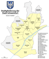 Karte Stadtteile Stadt Schweinfurt.png 1,344 × 1,594; 270 KB
-
 Lageplan Hafen Schweinfurt.png 850 × 929; 671 KB
-
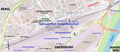 Lageplan Schweinfurt Hauptbahnhof.png 1,880 × 808; 1.18 MB
-
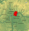
 Locator map SW (town) in Bavaria.svg 867 × 855; 1,010 KB
-
 Maintal bei Schweinfurt.png 1,101 × 495; 728 KB
-
 Schweinfurt 1792.png 3,635 × 2,469; 770 KB
-
 Schweinfurt-Gewässer.png 1,746 × 740; 1.31 MB
-
 Schweinfurt-Position.png 176 × 234; 5 KB
-
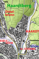 Schweinfurt. Lage des Stadtteils Haardt.png 387 × 581; 483 KB
-
 Schweinfurt. Lageplan Stadtteil Hafen-West.png 1,210 × 926; 986 KB
-
 Schweinfurt. Nordöstliches Stadtgebiet mit Ausläufern der Schweinfurter Rhön.png 1,652 × 910; 1.66 MB
-
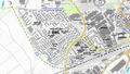 Schweinfurt. Plan Stadtteil Bergl.png 1,580 × 894; 1.41 MB
-
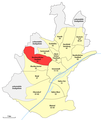
 Schweinfurt. Stadtteile im nordöstlichen Stadtgebiet.png 1,383 × 908; 1.43 MB
-
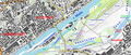
 Schweinfurter Mainbogen (2).png 1,411 × 808; 1,016 KB
-
 Schweinfurter Mainbogen.png 1,414 × 813; 1,021 KB
-
 SW (St) in Bayern.svg 1,227 × 1,236; 311 KB
-
 SW Sachs-Stadion und Umgebung.png 905 × 739; 622 KB
-
 SW Wildpark.png 1,093 × 840; 616 KB
-
 Unterer Sennfelder See und Dorfsee.png 1,746 × 740; 1.32 MB
-
 Weinbau in Schweinfurt.png 1,410 × 691; 975 KB


_in_Bavaria.svg)


.png)

_in_Bayern.svg)


