Category:Maps of Savigné-sur-Lathan
Jump to navigation
Jump to search
Wikimedia category | |||||
| Upload media | |||||
| Instance of | |||||
|---|---|---|---|---|---|
| Category combines topics | |||||
| Savigné-sur-Lathan | |||||
commune in Indre-et-Loire, France  .svg)  | |||||
| Pronunciation audio | |||||
| Instance of | |||||
| Named after |
| ||||
| Location |
| ||||
| Population |
| ||||
| Area |
| ||||
| official website | |||||
 | |||||
Media in category "Maps of Savigné-sur-Lathan"
The following 5 files are in this category, out of 5 total.
-
 37241-Savigné-sur-Lathan-argile.png 3,057 × 2,480; 2.5 MB
-
 37241-Savigné-sur-Lathan-Cours eau.jpg 3,507 × 2,480; 573 KB
-
 37241-Savigné-sur-Lathan-Hydro.jpeg 5,846 × 4,133; 1.94 MB
-
 37241-Savigné-sur-Lathan-Sols.png 3,270 × 2,598; 2.24 MB
-
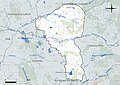
 Map commune FR insee code 37241.png 756 × 605; 63 KB


