Category:Maps of Samoëns
Jump to navigation
Jump to search
Wikimedia category | |||||
| Upload media | |||||
| Instance of | |||||
|---|---|---|---|---|---|
| Category combines topics | |||||
| Samoëns | |||||
commune in Haute-Savoie, France  .svg)  | |||||
| Instance of | |||||
| Location |
| ||||
| Population |
| ||||
| Area |
| ||||
| Elevation above sea level |
| ||||
| Different from | |||||
| official website | |||||
 | |||||
Subcategories
This category has the following 3 subcategories, out of 3 total.
E
- Ecological maps of Samoëns (3 F)
G
- Geological maps of Samoëns (8 F)
T
- Topographic maps of Samoëns (2 F)
Media in category "Maps of Samoëns"
The following 9 files are in this category, out of 9 total.
-
 74258-Samoëns - Localisation.png 3,507 × 2,480; 1.27 MB
-
 74258-Samoëns-Cadastre.png 7,015 × 4,960; 13.92 MB
-
 74258-Samoëns-Hydro.jpeg 5,846 × 4,133; 4.13 MB
-
 74258-Samoëns-Hydro.png 7,015 × 4,960; 6.64 MB
-
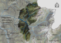 74258-Samoëns-Orthophoto.png 7,015 × 4,960; 54.76 MB
-
 74258-Samoëns-Sols.png 7,015 × 4,960; 7.13 MB
-
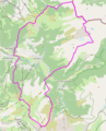
 Map commune FR insee code 74258.png 756 × 605; 119 KB
-
 MNHN-La Jaÿsinia.png 487 × 674; 145 KB
-
 Samoêns OSM 01.png 499 × 618; 283 KB


