Category:Maps of Saint Tammany Parish, Louisiana
Jump to navigation
Jump to search
Parishes of Louisiana: Acadia · Allen · Ascension · Assumption · Avoyelles · Beauregard · Bienville · Bossier · Caddo · Calcasieu · Caldwell · Cameron · Catahoula · Claiborne · Concordia · DeSoto · East Baton Rouge · East Carroll · East Feliciana · Evangeline · Franklin · Grant · Iberia · Iberville · Jackson · Jefferson · Jefferson Davis · Lafayette · Lafourche · LaSalle · Lincoln · Livingston · Madison · Morehouse · Natchitoches · Orleans · Ouachita · Plaquemines · Pointe Coupee · Rapides · Red River · Richland · Sabine · Saint Bernard · Saint Charles · Saint Helena · Saint James · Saint John the Baptist · Saint Landry · Saint Martin · Saint Mary · Saint Tammany · Tangipahoa · Tensas · Terrebonne · Union · Vermilion · Vernon · Washington · Webster · West Baton Rouge · West Carroll · West Feliciana · Winn
Wikimedia category | |||||
| Upload media | |||||
| Instance of | |||||
|---|---|---|---|---|---|
| Category combines topics | |||||
| St. Tammany Parish | |||||
parish in Louisiana, United States of America   | |||||
| Instance of | |||||
| Location | Louisiana | ||||
| Capital | |||||
| Inception |
| ||||
| Population |
| ||||
| Area |
| ||||
| official website | |||||
 | |||||
Saint Tammany Parish is located in Louisiana in the United States. Its parish seat is Covington.
Subcategories
This category has the following 3 subcategories, out of 3 total.
Media in category "Maps of Saint Tammany Parish, Louisiana"
The following 40 files are in this category, out of 40 total.
-

-

-

-
-

-
-
-

-
-
 Greater New Orleans 1970 Map.jpg 707 × 761; 160 KB
-
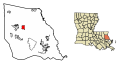
 LAMap-doton-Eden Isle.png 300 × 275; 12 KB
-
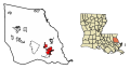
 LAMap-doton-Folsom.png 300 × 275; 12 KB
-
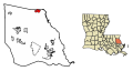
 LAMap-doton-Pearl River.png 300 × 275; 12 KB
-
 LAMap-doton-Sun.png 300 × 275; 12 KB
-
 Louisiana Senate District 1 (2010).png 3,165 × 2,781; 1,013 KB
-
 Louisiana Senate District 11 (2010).png 3,165 × 2,781; 991 KB
-
 Louisiana Senate District 12 (2010).png 3,165 × 2,781; 990 KB
-
 Map Eastern New Orleans to Gulfport MS 1982.jpg 6,976 × 3,828; 4.9 MB
-
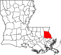 Map of Louisiana highlighting Saint Tammany Parish.svg 5,018 × 4,515; 269 KB
-

-
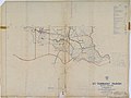
 Map of St. Tammany Parish Louisiana With Municipal Labels.PNG 667 × 576; 53 KB
-
 New Orleans-Metairie-Bogalusa CSA.png 542 × 490; 37 KB
-
 New Orleans–Metairie–Hammond combined statistical area.svg 997 × 1,200; 1.08 MB
-
 New Orleans–Metairie–Slidell combined statistical area.svg 997 × 1,200; 1.08 MB
-
 St Tammany Parish Louisiana.png 300 × 275; 14 KB
-
 St. Tammany Parish .png 2,176 × 1,760; 1.76 MB
-
-

-

-

-

-

-

-

-
-
-
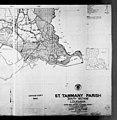
 St. Tammany Parish Map.png 654 × 730; 453 KB
-
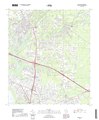 USGS Topo Map Covington, LA 2018.pdf 3,600 × 4,350; 52.99 MB
-
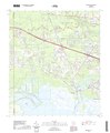 USGS Topo Map Madisonville, LA 2020.pdf 3,600 × 4,350; 48.36 MB
-
 USGS Topo Map Mandeville, LA 2018.pdf 3,600 × 4,350; 30.88 MB
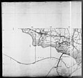
_-_St._Tammany_Parish_-_ED_52-1_-_ED_52-26_-_NARA_-_5832271_(page_1).jpg)
_-_St._Tammany_Parish_-_ED_52-1_-_ED_52-26_-_NARA_-_5832271_(page_2).jpg)
_-_St._Tammany_Parish_-_ED_52-1_-_ED_52-26_-_NARA_-_5832271_(page_3).jpg)
_-_St._Tammany_Parish_-_ED_52-1_-_ED_52-26_-_NARA_-_5832271_(page_5).jpg)
_-_St._Tammany_Parish_-_ED_52-1_-_ED_52-26_-_NARA_-_5832271_(page_6).jpg)
_-_St._Tammany_Parish_-_ED_52-1_-_ED_52-26_-_NARA_-_5832271_(page_7).jpg)
_-_St._Tammany_Parish_-_ED_52-1_-_ED_52-26_-_NARA_-_5832271_(page_8).jpg)
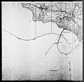
_-_St._Tammany_Parish_-_St._Tammany_Parish_-_ED_52-1_to_44_-_NARA_-_12171862_(page_1).jpg)
_-_St._Tammany_Parish_-_St._Tammany_Parish_-_ED_52-1_to_44_-_NARA_-_12171862_(page_2).jpg)


.png)
.png)
.png)


