Category:Maps of Plymouth, Massachusetts
Jump to navigation
Jump to search
Wikimedia category | |||||
| Upload media | |||||
| Instance of | |||||
|---|---|---|---|---|---|
| Category combines topics | |||||
| Plymouth | |||||
county seat town in Plymouth County, Massachusetts, United States     | |||||
| Instance of | |||||
| Part of | |||||
| Named after | |||||
| Location | Plymouth County, Massachusetts | ||||
| Inception |
| ||||
| Population |
| ||||
| Area |
| ||||
| Elevation above sea level |
| ||||
| Different from | |||||
| official website | |||||
 | |||||
Subcategories
This category has the following 3 subcategories, out of 3 total.
Media in category "Maps of Plymouth, Massachusetts"
The following 36 files are in this category, out of 36 total.
-
 1755 PlymouthMA detail of map byJohnGreen BPL 12281.png 1,060 × 748; 1.27 MB
-
 1830 map Plymouth Massachusetts byBourne BPL 12878 detail.png 916 × 735; 965 KB
-

-
 1882 bird's-eye view map of Plymouth, Massachusetts LOC 2011589144.tif 11,707 × 9,154; 306.6 MB
-
 1882 bird's-eye view map of Plymouth, Massachusetts.jpg 11,707 × 9,154; 17.46 MB
-
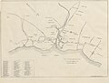
 1882 map Plymouth Massachusetts byBailey BPL 10175.png 1,018 × 701; 1.16 MB
-
-
 A map of Plymouth Village, 1846 (3720083929).jpg 1,024 × 823; 669 KB
-
 Admiralty Chart No 2482 Fletchers Neck to Cape Cod, Published 1866.jpg 8,208 × 12,001; 9.15 MB
-
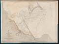
 Admiralty Chart No 2486 Plymouth Harbour (Massachusetts), Published1857.jpg 8,005 × 6,081; 7.54 MB
-
 Boston, a guide book (1910) (14576610538).jpg 1,804 × 1,692; 508 KB
-
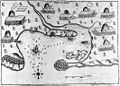 Champlain's Map of Plymouth Harbor.jpg 530 × 382; 124 KB
-
 Chart of Plymouth Bay (10295678726).jpg 586 × 799; 63 KB
-
 Chart of Plymouth Bay (3045701551).jpg 1,446 × 2,000; 2.51 MB
-
 Chart of Plymouth Bay (7557412140).jpg 3,990 × 5,360; 18.92 MB
-
 Chart of Plymouth Bay. LOC 77693976.jpg 4,906 × 6,586; 4.12 MB
-
 Chart of Plymouth Bay. LOC 77693976.tif 4,906 × 6,586; 92.44 MB
-
 Hubbard map 1677.JPG 1,518 × 1,172; 535 KB
-
 Map of Plymouth settled in 1620 (3720083685).jpg 709 × 1,024; 713 KB
-
 Map of the town of Plymouth, Plymouth Co. Mass. (3886419125).jpg 1,494 × 2,000; 2.25 MB
-
 Massachusetts location Plymouth.svg 500 × 314; 176 KB
-
 America, East Coast - Plymouth Harbour (IA McGillLibrary-rbsc map bayfield-145-19322).pdf 4,000 × 3,039; 13.78 MB
-
 Plimoth Plantation Highway.png 1,149 × 676; 36 KB
-
-

-

-

-
 Plymouth Harbor, Massachusetts LOC 79695321.jpg 7,236 × 6,508; 7.1 MB
-
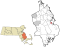
 Plymouth ma highlight.png 788 × 466; 54 KB
-
 Plymouth station on 1882 bird's-eye view map.jpg 1,223 × 885; 262 KB
-
 Southern New England in 1634.jpg 600 × 882; 140 KB
-
 Southern New England, 1620–22 (rev).jpg 8,973 × 9,746; 8.2 MB
-

-
 The Atlantic Neptune, published for the use of the Royal Navy of Great Britain, LOC 75332515-10.tif 5,920 × 7,940; 134.48 MB
-
 Trolley trips through New England (1900) (14779532552).jpg 2,036 × 1,228; 374 KB
-
 Wôpanâak Nation c 1620-01.svg 512 × 374; 79 KB


%27_(11163798993).jpg)
.jpg)

,_Published1857.jpg)
_(14576610538).jpg)

.jpg)
.jpg)
.jpg)


.jpg)
.jpg)


_highlighted.svg)


.jpg)

_(14779532552).jpg)
