Category:Maps of Plymouth
Jump to navigation
Jump to search
Wikimedia category | |||||
| Upload media | |||||
| Instance of | |||||
|---|---|---|---|---|---|
| Category combines topics | |||||
| Plymouth | |||||
city in Devon, England  | |||||
| Instance of |
| ||||
| Patron saint | |||||
| Location | City of Plymouth, Devon, South West England, England | ||||
| Located in or next to body of water | |||||
| Significant event |
| ||||
| Population |
| ||||
| Area |
| ||||
| Different from | |||||
| official website | |||||
 | |||||
Subcategories
This category has the following 2 subcategories, out of 2 total.
C
- Charts of Plymouth Sound (8 F)
Media in category "Maps of Plymouth"
The following 82 files are in this category, out of 82 total.
-
 Britannica Plymouth and Environs.png 1,453 × 1,487; 1.22 MB
-
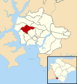
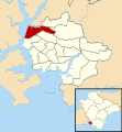 Budshead ward in Plymouth 1979.svg 1,100 × 1,187; 648 KB
-
 Budshead ward in Plymouth 2003.svg 1,100 × 1,187; 613 KB
-
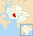
 Compton ward in Plymouth 1979.svg 1,100 × 1,187; 648 KB
-
 Compton ward in Plymouth 2003.svg 1,100 × 1,187; 613 KB
-
 Devonport Leat map.png 2,000 × 1,993; 2.43 MB
-
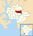
 Devonport ward in Plymouth 2003.svg 1,100 × 1,187; 613 KB
-
 Drake ward in Plymouth 1979.svg 1,100 × 1,187; 648 KB
-
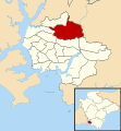
 Drake ward in Plymouth 2003.svg 1,100 × 1,187; 613 KB
-
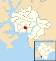
 Efford and Lipson ward in Plymouth 2003.svg 1,100 × 1,187; 613 KB
-
 Efford ward in Plymouth 1979.svg 1,100 × 1,187; 648 KB
-
 Eggbuckland ward in Plymouth 1979.svg 1,100 × 1,187; 648 KB
-
 Eggbuckland ward in Plymouth 2003.svg 1,100 × 1,187; 613 KB
-
 EnglandPlymouth.png 200 × 247; 25 KB
-
 Estover ward in Plymouth 1979.svg 1,100 × 1,187; 648 KB
-
 Ham ward in Plymouth 1979.svg 1,100 × 1,187; 648 KB
-
 Ham ward in Plymouth 2003.svg 1,100 × 1,187; 613 KB
-
 Honicknowle ward in Plymouth 1979.svg 1,100 × 1,187; 648 KB
-
 Honicknowle ward in Plymouth 2003.svg 1,100 × 1,187; 613 KB
-
 Keyham ward in Plymouth 1979.svg 1,100 × 1,187; 648 KB
-
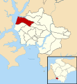
 Location map of Drake (ward) within Plymouth.svg 1,100 × 1,187; 721 KB
-
 Location map United Kingdom Plymouth Central.png 2,115 × 1,888; 1.76 MB
-
 Moor View ward in Plymouth 2003.svg 1,100 × 1,187; 613 KB
-
 Mount Gould ward in Plymouth 1979.svg 1,100 × 1,187; 648 KB
-
 Peverell ward in Plymouth 2003.svg 1,100 × 1,187; 613 KB
-
 Plymouth City Council election 1979 map.svg 1,100 × 1,187; 649 KB
-
 Plymouth City Council election 1983 map.svg 1,100 × 1,187; 649 KB
-
 Plymouth City Council election 1987 map.svg 1,100 × 1,187; 649 KB
-
 Plymouth City Council election 1991 map.svg 1,100 × 1,187; 649 KB
-
 Plymouth City Council election 1995 map.svg 1,100 × 1,187; 649 KB
-
 Plymouth City Council election 1997 map.svg 1,100 × 1,187; 649 KB
-
 Plymouth City Council election 2000 map.svg 1,100 × 1,187; 649 KB
-
 Plymouth City Council election 2003 map.svg 1,100 × 1,187; 613 KB
-
 Plymouth City Council election 2004 map.svg 1,100 × 1,187; 611 KB
-
 Plymouth City Council election 2006 map.svg 1,100 × 1,187; 612 KB
-
 Plymouth City Council election 2007 map.svg 1,100 × 1,187; 612 KB
-
 Plymouth City Council election 2008 map.svg 1,100 × 1,187; 611 KB
-
 Plymouth City Council election 2010 map.svg 1,100 × 1,187; 612 KB
-
 Plymouth City council election 2011 map.svg 512 × 552; 244 KB
-
 Plymouth City Council election 2011 map.svg 1,100 × 1,187; 613 KB
-
 Plymouth City council election 2012 map.svg 1,100 × 1,187; 344 KB
-
 Plymouth City Council election 2014 map.svg 1,100 × 1,187; 429 KB
-
 Plymouth City Council wards 1979 to 2003 map.svg 1,100 × 1,187; 648 KB
-
 Plymouth Citybus 28 route July 2015.svg 1,131 × 812; 1.24 MB
-
 Plymouth Citybus network map 2015 (Plymouth area).svg 1,260 × 1,015; 1,010 KB
-
 Plymouth Citybus Route Map Sep2017.jpg 4,896 × 3,672; 5.12 MB
-
 Plymouth Development Corporation sites map.png 361 × 406; 59 KB
-
 Plymouth in the UK.png 333 × 487; 40 KB
-
 Plymouth shown within Devon and UK.png 580 × 579; 559 KB
-
 Plymouth Sound, Shores and Cliffs map.png 700 × 700; 311 KB
-
 Plymouth tramways network.png 960 × 720; 76 KB
-
 Plymouth UK local election 2010 map.svg 1,100 × 1,187; 615 KB
-
 Plymouth UK location map.svg 1,100 × 1,187; 573 KB
-
 Plymouth UK locator map.svg 1,292 × 1,187; 1.43 MB
-
 Plymouth UK political composition map.svg 1,100 × 1,187; 615 KB
-
 Plymouth UK ward map (blank).svg 1,100 × 1,187; 612 KB
-
 PlymouthDevonportConstituency.svg 200 × 199; 17 KB
-
 PlymouthMoorView2007Constituency.svg 207 × 206; 167 KB
-
 PlymouthSuttonConstituency.svg 200 × 199; 17 KB
-
 PlymouthSuttonDevonport2007Constituency.svg 207 × 206; 167 KB
-
 Plympton Chaddlewood ward in Plymouth 2003.svg 1,100 × 1,187; 613 KB
-
 Plympton Dunstone ward in Plymouth 2003.svg 1,100 × 1,187; 613 KB
-
 Plympton Erle ward in Plymouth 1979.svg 1,100 × 1,187; 648 KB
-
 Plympton Erle ward in Plymouth 2003.svg 1,100 × 1,187; 613 KB
-
 Plympton Radford ward in Plymouth 2003.svg 1,100 × 1,187; 613 KB
-
 Plympton St Mary ward in Plymouth 1979.svg 1,100 × 1,187; 648 KB
-
 Plympton St Mary ward in Plymouth 2003.svg 1,100 × 1,187; 613 KB
-
 Plymstock Dunstone ward in Plymouth 1979.svg 1,100 × 1,187; 648 KB
-
 Plymstock Radford ward in Plymouth 1979.svg 1,100 × 1,187; 648 KB
-
 Route of the 1974 Tour de France.png 3,198 × 3,204; 2.79 MB
-
 Southway ward in Plymouth 1979.svg 1,100 × 1,187; 648 KB
-
 Southway ward in Plymouth 2003.svg 1,100 × 1,187; 613 KB
-
 St Budeaux ward in Plymouth 1979.svg 1,100 × 1,187; 648 KB
-
 St Budeaux ward in Plymouth 2003.svg 1,100 × 1,187; 613 KB
-
 St Peter and the Waterfront ward in Plymouth 2003.svg 1,100 × 1,187; 613 KB
-
 St Peter ward in Plymouth 1979.svg 1,100 × 1,187; 648 KB
-
 Stoke ward in Plymouth 1979.svg 1,100 × 1,187; 648 KB
-
 Stoke ward in Plymouth 2003.svg 1,100 × 1,187; 613 KB
-
 Sutton and Mount Gould ward in Plymouth 2003.svg 1,100 × 1,187; 613 KB
-
 Sutton ward in Plymouth 1979.svg 1,100 × 1,187; 648 KB
-
 The Street railway journal (1899) (14572808477).jpg 2,240 × 1,696; 761 KB
-
 Trelawny ward in Plymouth 1979.svg 1,100 × 1,187; 648 KB


_within_Plymouth.svg)


.svg)


_(14572808477).jpg)

.svg)