Category:Maps of North America, NYPL collection
Jump to navigation
Jump to search
Media in category "Maps of North America, NYPL collection"
The following 200 files are in this category, out of 213 total.
(previous page) (next page)-
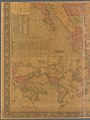
 Novi Belgii (NYPL b10547963-5247814).jpg 8,103 × 6,655; 47.74 MB
-
 Map of Belknap County, New Hampshire (NYPL b11655870-5247837).jpg 6,169 × 9,064; 54.34 MB
-
 Map of Belknap County, New Hampshire (NYPL b11655870-5247838).jpg 6,169 × 9,071; 53.25 MB
-
 Map of Belknap County, New Hampshire (NYPL b11655870-5247839).jpg 6,093 × 9,200; 52.02 MB
-
 Map of Belknap County, New Hampshire (NYPL b11655870-5247840).jpg 6,103 × 9,282; 53.27 MB
-
 Map of Belknap County, New Hampshire (NYPL b11655870-5247841).jpg 6,140 × 9,234; 53.97 MB
-
 Map of Belknap County, New Hampshire (NYPL b11655870-5247842).jpg 6,144 × 9,163; 52.99 MB
-

-

-

-
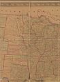
 Western states (NYPL b14408742-5247817).jpg 8,860 × 5,499; 44.43 MB
-
-

-
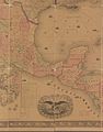
 A new map of ye north parts of America claimed by France (NYPL b14903431-5247820).jpg 5,741 × 4,166; 22.98 MB
-
-

-

-

-

-

-
 Plan of Baltimore (NYPL b14948186-434944).jpg 4,615 × 3,987; 3.72 MB
-
 Plan of the town of Baltimore and it's (sic) environs (NYPL b14948191-434630).jpg 4,768 × 5,514; 4.06 MB
-
 Plan of part of Weverton (NYPL b14948223-434635).jpg 4,448 × 6,091; 6.32 MB
-

-

-

-

-
 Mouth of Chester River - (Harbor of Refuge no. ) (NYPL b14950963-434638).jpg 5,056 × 6,288; 5.6 MB
-
 Mouth of Chester River - (Harbor of Refuge no. ) (NYPL b14950963-483729).jpg 5,088 × 5,771; 3.46 MB
-

-

-

-
 Maryland (NYPL b14968646-435002).jpg 4,133 × 2,240; 2.02 MB
-
 Maryland (NYPL b14968670-435003).jpg 4,276 × 4,850; 3.53 MB
-

-

-

-

-

-

-

-

-
 Map of the northern parts of the United States of America (NYPL b15079258-434052).jpg 5,530 × 3,888; 4.62 MB
-
 Middle States - Maryland & Virginia (NYPL b15108579-434028).jpg 4,480 × 5,891; 5.73 MB
-

-

-

-

-

-

-

-

-
 A Map of the British and French settlements in North America (NYPL b15180032-434069).jpg 4,688 × 3,944; 4.28 MB
-
 A Map of the British and French settlements in North America (NYPL b15180032-483705).jpg 5,408 × 4,376; 5.24 MB
-

-

-

-

-

-

-

-

-
-

-

-

-

-

-

-

-
 Map of the seat of war in North America (NYPL b15393384-433915).jpg 5,803 × 4,528; 4.53 MB
-

-

-

-
 Map of the city of St. Louis, Mo., 1861 (NYPL b15842301-1952952).jpg 4,109 × 2,011; 3.59 MB
-

-

-

-

-

-

-

-

-

-

-

-

-

-

-

-

-

-
 Map of the Union Pacific Railroad and its connections (NYPL b16024982-1267451).jpg 14,405 × 4,071; 15.04 MB
-
 Linguistic stocks of American Indians north of Mexico (NYPL b16149052-1407867).jpg 5,248 × 6,299; 9.17 MB
-
 Historical map of the state of Connecticut (NYPL b17973623-1692441).jpg 6,120 × 4,608; 36.07 MB
-
 Map of the U. S. and Territories…North Central (NYPL b18036847-psnypl map 300).jpg 4,536 × 5,360; 7.25 MB
-
 Map of the U. S. and Territories…North East (NYPL b18036847-psnypl map 299).jpg 4,600 × 5,352; 6.1 MB
-
 A map of the state of New Jersey with part of the adjoining states (NYPL b18222671-5255485).jpg 7,687 × 9,844; 75.78 MB
-
 A map of the state of New Jersey with part of the adjoining states (NYPL b18222671-5255486).jpg 7,760 × 9,806; 81.27 MB
-
 A map of the state of New Jersey with part of the adjoining states (NYPL b18222671-5255487).jpg 7,590 × 9,836; 79.93 MB
-
 Chart of the coast of California from San Blas to San Francisco (NYPL b18890876-5386996).jpg 7,651 × 9,347; 62.93 MB
-
 Chart of the coast of California from San Blas to San Francisco (NYPL b18890876-5386998).jpg 7,557 × 9,358; 57.23 MB
-
-

-

-

-

-

-
 Chart of Lake Ontario (NYPL b19531878-5376740).jpg 7,323 × 8,874; 58.27 MB
-
 Chart of Lake Ontario (NYPL b19531878-5376741).jpg 7,604 × 8,899; 61.6 MB
-
 Chart of Lake Ontario (NYPL b19531878-5376742).jpg 7,357 × 8,920; 55.94 MB
-

-

-

-

-

-

-

-

-

-

-

-

-

-

-

-

-

-

-

-

-

-

-

-

-

-
 Draughts of land in Amwell in Hunterdon, Ocbr. 27th 1752 (NYPL b19605260-5365465).jpg 6,580 × 8,212; 48.16 MB
-

-
 Carte contenant le royaume du Mexique et la Floride (NYPL b20292772-5476418).jpg 7,882 × 6,249; 45.44 MB
-
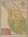 No. 15 map of Oregon and Upper California (NYPL b20308175-5247821).jpg 3,958 × 5,251; 20.34 MB
-
 Plan of the town of Newton in 1700 (NYPL b20625571-5365404).jpg 8,586 × 6,851; 47.89 MB
-

-
 Champlain's map of New France 1632 (NYPL b20643233-5476419).jpg 9,409 × 6,158; 51.55 MB
-
 Pas-caart van de Suyd-Rivier in Nieu-Nederland (NYPL b20643830-5452681).jpg 9,021 × 5,470; 47.12 MB
-
 A new and accurate map of the present war in North America (NYPL b20643833-5403998).jpg 8,398 × 6,658; 51.9 MB
-
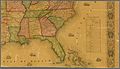
 A general map of the southern British colonies in America (NYPL b20643836-5404010).jpg 8,679 × 6,982; 53.27 MB
-

-

-

-

-

-
-

-

-
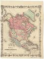 Colton's North America (NYPL b20643851-5452683).jpg 6,612 × 8,827; 57.15 MB
-
-

-

-
-

-

-

-

-

-

-

-

-
 A map of part of the N. W. Territory of the United States (NYPL b20643865-5452686).jpg 9,371 × 7,190; 58.09 MB
-

-

-
 Colton's railroad & township map, western states (NYPL b20643897-5567345).jpg 12,740 × 10,180; 28.97 MB
-
 Milk R. to the crossing of the Columbia R (NYPL b20643910-5553787).jpg 19,313 × 7,995; 29.22 MB
-

-

-

-

-

-

-

-

-
 Map of the great north west (NYPL b20644030-5831485).jpg 7,792 × 7,529; 43.76 MB
-
 Carta particolare della nuoua Belgia è parte della nuoua Anglia (NYPL b20644060-5831483).jpg 6,956 × 8,424; 39.86 MB
-
 New England states (NYPL b20644066-5831480).jpg 5,854 × 9,411; 49.23 MB
-
 Map of the Eastern States (NYPL b20644067-5831481).jpg 6,780 × 8,297; 52.4 MB
-
 A map of the New England states (NYPL b20644070-5848184).tiff 7,760 × 10,328, 2 pages; 229.61 MB
-
 A map of the New England states (NYPL b20644070-5848185).tiff 7,760 × 10,328, 2 pages; 229.61 MB
-
 A map of the New England states (NYPL b20644070-5848186).tiff 7,760 × 10,328, 2 pages; 229.61 MB
-
 A map of the New England states (NYPL b20644070-5848187).tiff 7,760 × 10,328, 2 pages; 229.61 MB
-
 A map of the New England states (NYPL b20644070-5848188).tiff 14,811 × 19,144; 811.5 MB
-

-
 Map of Massachusetts, Connecticut and Rhode Island (NYPL b20644111-5831484).jpg 9,167 × 7,279; 61.23 MB
-
 A new map of the Cherokee Nation (NYPL b20719744-5387010).jpg 7,597 × 5,863; 43.74 MB
-
 Map of North America (NYPL b20731631-5404011).jpg 7,280 × 8,457; 65.55 MB
-

-
-

-

-
-

-
 Lloyd's topographical map of America, 1871 (NYPL b20733340-5404019).jpg 9,658 × 7,556; 81.21 MB
.jpg)
.jpg)
.jpg)
.jpg)
.jpg)
.jpg)
.jpg)
.jpg)
.jpg)
.jpg)
.jpg)
.jpg)
.jpg)
.jpg)
.jpg)
.jpg)
.jpg)
.jpg)
.jpg)
.jpg)
.jpg)
_environs_(NYPL_b14948191-434630).jpg)
.jpg)
.jpg)
.jpg)
.jpg)
.jpg)
_(NYPL_b14950963-434638).jpg)
_(NYPL_b14950963-483729).jpg)
.jpg)
.jpg)
.jpg)
.jpg)
.jpg)
.jpg)
.jpg)
.jpg)
.jpg)
.jpg)
.jpg)
.jpg)
.jpg)
.jpg)
.jpg)
.jpg)
.jpg)
.jpg)
.jpg)
.jpg)
.jpg)
.jpg)
.jpg)
.jpg)
.jpg)
_regionum_nova_descriptio_(NYPL_b15180119-434010).jpg)
.jpg)
.jpg)
.jpg)
.jpg)
.jpg)
.jpg)
.jpg)
.jpg)
.jpg)
.jpg)
.jpg)
.jpg)
.jpg)
.jpg)
.jpg)
.jpg)
.jpg)
.jpg)
.jpg)
.jpg)
.jpg)
.jpg)
.jpg)
.jpg)
.jpg)
.jpg)
.jpg)
.jpg)
.jpg)
.jpg)
.jpg)
.jpg)
.jpg)
.jpg)
.jpg)
.jpg)
.jpg)
.jpg)
.jpg)
.jpg)
.jpg)
.jpg)
.jpg)
.jpg)
.jpg)
.jpg)
.jpg)
.jpg)
.jpg)
_(NYPL_b19605260-5365418).jpg)
_(NYPL_b19605260-5365419).jpg)
_(NYPL_b19605260-5365420).jpg)
_(NYPL_b19605260-5365421).jpg)
_in_company_Edmd._Beakes,_Thoms._Middleton_%26_Ab._Tilton_(1741-2,_survey_of_land_near_Crosswicks_Creek_and_Doctors_Creek,_New_Jersey,_by_(NYPL_b19605260-5365422).jpg)
_(NYPL_b19605260-5365427).jpg)
_(NYPL_b19605260-5365428).jpg)
_(NYPL_b19605260-5365429).jpg)
_(NYPL_b19605260-5365430).jpg)
_(NYPL_b19605260-5365431).jpg)
_(NYPL_b19605260-5365432).jpg)
_(NYPL_b19605260-5365433).jpg)
,_by_order_of_James_Alexander)_(NYPL_b19605260-5365434).jpg)
,_by_order_of_James_Alexander)_(NYPL_b19605260-5365435).jpg)
,_by_order_of_James_Alexander)_(NYPL_b19605260-5365436).jpg)
,_by_order_of_James_Alexander)_(NYPL_b19605260-5365437).jpg)
_(NYPL_b19605260-5365443).jpg)
_(NYPL_b19605260-5365444).jpg)
_(NYPL_b19605260-5365446).jpg)
_(NYPL_b19605260-5365448).jpg)
_(NYPL_b19605260-5365449).jpg)
_(NYPL_b19605260-5365450).jpg)
_(NYPL_b19605260-5365451).jpg)
_(NYPL_b19605260-5365452).jpg)
.jpg)
_(NYPL_b19605260-5365466).jpg)
.jpg)
.jpg)
.jpg)
.jpg)
.jpg)
.jpg)
.jpg)
.jpg)
.jpg)
.jpg)
.jpg)
.jpg)
.jpg)
.jpg)
.jpg)
.jpg)
.jpg)
.jpg)
.jpg)
.jpg)
.jpg)
.jpg)
.jpg)
.jpg)
.jpg)
.jpg)
.jpg)
.jpg)
.jpg)
.jpg)
.jpg)
.jpg)
.jpg)
.jpg)
.jpg)
.jpg)
.jpg)
.jpg)
.jpg)
.jpg)
.jpg)
.jpg)
.jpg)
.jpg)
.jpg)
.jpg)
.jpg)
.jpg)
.jpg)
.jpg)
.jpg)
.jpg)
.jpg)
.jpg)
.jpg)
.jpg)
.jpg)
.jpg)
.jpg)
.jpg)
.jpg)
.jpg)
.jpg)