Category:Maps of New Britain
Jump to navigation
Jump to search
Wikimedia category | |||||
| Upload media | |||||
| Instance of | |||||
|---|---|---|---|---|---|
| Category combines topics | |||||
| New Britain | |||||
island of the Bismarck Archipelago in Papua New Guinea  Satelitní snímek Nové Británie z června 2005  | |||||
| Instance of | |||||
| Part of | |||||
| Location |
| ||||
| Located in or next to body of water | |||||
| Capital | |||||
| Discoverer or inventor | |||||
| Time of discovery or invention |
| ||||
| Width |
| ||||
| Length |
| ||||
| Highest point | |||||
| Population |
| ||||
| Area |
| ||||
| Elevation above sea level |
| ||||
 | |||||
Subcategories
This category has the following 4 subcategories, out of 4 total.
G
M
- Maps of Rabaul caldera (4 F)
- Maps of Willaumez Peninsula (4 F)
Media in category "Maps of New Britain"
The following 39 files are in this category, out of 39 total.
-
 NewBritainOMC.png 491 × 349; 10 KB
-
 NewBritainTopography.png 2,208 × 1,506; 1.31 MB
-
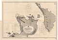
 Rabaul - map.jpg 644 × 438; 89 KB
-
 Rabaul and its airfields 1943.jpg 2,500 × 1,855; 730 KB
-
 Location map East New Britain Province.png 717 × 753; 687 KB
-
 Location map West New Britain Province.png 1,080 × 701; 815 KB
-
 Ataliklikun Bay.png 782 × 558; 550 KB
-
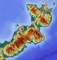
 Urara Island locator.png 782 × 558; 550 KB
-
 Watom Island.png 782 × 558; 550 KB
-
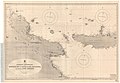
 Rabaul - map 02.jpg 670 × 598; 89 KB
-
 Admiralty Chart No 2003 Vitu Islands to Watom Island, Published 1960.jpg 19,029 × 11,277; 42.22 MB
-
 Admiralty Chart No 3553 Gazelle Peninsula and St George's Channel, Published 1909.jpg 12,360 × 8,592; 17.39 MB
-

-
-
 Arawe Landings.png 1,448 × 1,096; 1.31 MB
-
 Backhander Staging Area - New Britain - New Guinea.png 1,200 × 1,549; 340 KB
-
 Bougainville - Carte Port-Praslin.jpg 2,739 × 3,629; 2.26 MB
-
 Cape Gloucester - Map01.png 2,231 × 1,175; 644 KB
-
 Cape Gloucester - Map02.png 2,593 × 1,725; 1.39 MB
-

-
 Commodore Bai.jpg 512 × 789; 113 KB
-
 Huon Peninsula and the Straits.png 2,500 × 1,269; 1.48 MB
-
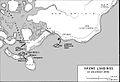
 Japanese Ground Dispositions.jpg 1,984 × 1,383; 922 KB
-
 Japanese Withdrawal Routes in West New Britain.jpg 1,054 × 740; 229 KB
-
 Karte aus dem Deutschen Kolonialatlas mit den Baining Bergen.jpg 1,072 × 755; 171 KB
-
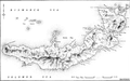
 Krater Halbinsel, Neubritannien.jpg 3,024 × 4,032; 3.57 MB
-
 Warangoi River.png 864 × 731; 1.06 MB
-
 Map of Australian operations on New Britain October 1944-March 1945.jpg 1,313 × 736; 297 KB
-
 Map of Henry Reid Bay.jpg 1,235 × 811; 84 KB
-
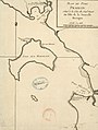
 Map of the Allied landings at Arawe on 15 December 1943.jpg 1,161 × 798; 162 KB
-

-
 New Britain map Long p 243.png 768 × 478; 202 KB
-
 New Britain WW2 map.jpg 1,200 × 554; 163 KB
-
 NewBritain2022OSM.png 7,395 × 3,500; 16.12 MB
-
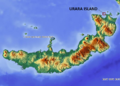
 Urara Island.png 845 × 663; 12 KB
-
 Urara Island.svg 792 × 622; 9 KB
-
 Watom Island 1910 German map.jpg 3,640 × 5,299; 5.37 MB
-
 West New Britain.png 3,095 × 1,759; 1.91 MB
-
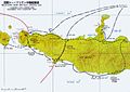 Western New Britain Operation.jpg 800 × 565; 94 KB


