Category:Maps of Montbouy
Jump to navigation
Jump to search
Wikimedia category | |||||
| Upload media | |||||
| Instance of | |||||
|---|---|---|---|---|---|
| Category combines topics | |||||
| Montbouy | |||||
commune in Loiret, France   | |||||
| Instance of | |||||
| Location |
| ||||
| Located in or next to body of water | |||||
| Population |
| ||||
| Area |
| ||||
| official website | |||||
 | |||||
Subcategories
This category has only the following subcategory.
G
- Geological maps of Montbouy (8 F)
Media in category "Maps of Montbouy"
The following 10 files are in this category, out of 10 total.
-
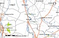 45 Znieff 200.jpg 5,457 × 3,543; 1.23 MB
-
 45-Montbouy-Routes.png 5,484 × 3,543; 2.15 MB
-
 45210-Montbouy-argile.png 3,057 × 2,480; 2.68 MB
-
 45210-Montbouy-Cours eau.jpg 3,507 × 2,480; 564 KB
-
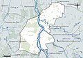 45210-Montbouy-Hydro.jpeg 5,846 × 4,133; 1.9 MB
-
 45210-Montbouy-Orthophoto.jpeg 10,559 × 7,440; 10.64 MB
-
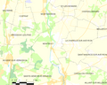
 45210-Montbouy-Sols.png 3,519 × 2,480; 2.14 MB
-
 Map commune FR insee code 45210.png 756 × 605; 53 KB
-
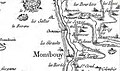 Montbouy-Cheneviere - carte de Cassini.JPG 744 × 438; 119 KB
-
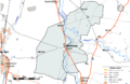
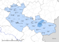 Montbouy-Interco.png 3,507 × 2,480; 1.4 MB


