Category:Maps of Mauritius Island
Jump to navigation
Jump to search
Media in category "Maps of Mauritius Island"
The following 26 files are in this category, out of 26 total.
-
 000 Mauritius harta.PNG 330 × 355; 9 KB
-

-

-
 Carte de Maurice-LMB.jpg 260 × 258; 19 KB
-
 Carte de Maurice.jpg 1,000 × 1,206; 230 KB
-
 Karte von Mauritius.png 330 × 355; 13 KB
-
 Map of Mauritius mk.svg 1,049 × 1,130; 1.43 MB
-
 Map of Mauritius.png 2,332 × 2,510; 1.23 MB
-
 Map of Mauritius.svg 1,049 × 1,130; 1.43 MB
-
 Mapa Mauricia.png 330 × 355; 12 KB
-
 Mauritius CIA map PL.png 330 × 355; 10 KB
-
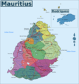
 Mauritius districts named.png 500 × 541; 19 KB
-
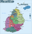
 Mauritius Island map-fr.jpg 1,810 × 2,160; 834 KB
-
 Mauritius Island map-fr.svg 1,810 × 2,160; 1.44 MB
-
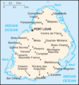 Mauritius map CIA.png 330 × 355; 17 KB
-
 Mauritius Map With Historical Places.png 330 × 355; 22 KB
-
 Mauritius map.jpg 471 × 438; 66 KB
-
 Mauritius rel90.jpg 1,000 × 1,206; 236 KB
-
 Mauritius relief location map.jpg 1,400 × 1,908; 845 KB
-
 Mauritius-CIA WFB Map sl.png 330 × 355; 16 KB
-
 Mauritius-CIA WFB Map.png 330 × 355; 9 KB
-
 Mauritius-Map.png 330 × 355; 7 KB
-
 Mauritiushoogtekaart02.jpg 380 × 482; 49 KB
-
 Mauritiuskaart.png 440 × 473; 42 KB
-
 Mp-map.png 330 × 355; 9 KB
-
 Rigobert-Bonne-Atlas-de-toutes-les-parties-connues-du-globe-terrestre MG 9991.tif 5,230 × 3,564; 53.36 MB

.jpg)
.jpg)


