Category:Maps of Maubeuge
Jump to navigation
Jump to search
Wikimedia category | |||||
| Upload media | |||||
| Instance of | |||||
|---|---|---|---|---|---|
| Category combines topics | |||||
| Maubeuge | |||||
commune in Nord, France  "Maubeuge kapuja"   | |||||
| Instance of | |||||
| Location | |||||
| Head of government | |||||
| Inception |
| ||||
| Significant event |
| ||||
| Population |
| ||||
| Area |
| ||||
| Elevation above sea level |
| ||||
| official website | |||||
 | |||||
Subcategories
This category has the following 2 subcategories, out of 2 total.
M
O
Media in category "Maps of Maubeuge"
The following 10 files are in this category, out of 10 total.
-
 59-AAV2020-Maubeuge (partie française).png 3,519 × 3,197; 2.46 MB
-
 59-Maubeuge (partie française)-AAV2020.png 3,519 × 2,930; 1.4 MB
-
 59392-Maubeuge-Hydro.jpeg 5,846 × 4,133; 3.44 MB
-
 59392-Maubeuge-Sols.png 3,270 × 2,598; 5.09 MB
-
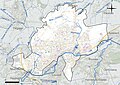
 Aireurbainemaubeuge.svg 3,489 × 2,329; 748 KB
-
 Carte industries - Maubeuge - 1925.jpg 1,632 × 1,027; 261 KB
-
 ComunnagloMaubeuge.JPG 427 × 332; 28 KB
-
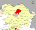
 Map commune FR insee code 59392.png 756 × 605; 65 KB
-
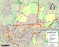
 Maubeuge OSM 01.png 711 × 549; 239 KB
-
 Maubeuge OSM 02.png 711 × 549; 452 KB
.png)
-AAV2020.png)


