Category:Maps of Long Beach Island
Jump to navigation
Jump to search
Media in category "Maps of Long Beach Island"
The following 20 files are in this category, out of 20 total.
-
 Long-beach-island-map-with-locales.png 580 × 580; 48 KB
-
 Beach changes at Long Beach Island, New Jersey, 1962-73 (1980) (20170558860).jpg 1,730 × 2,274; 540 KB
-
 Beach changes at Long Beach Island, New Jersey, 1962-73 (1980) (20170560940).jpg 1,796 × 2,232; 588 KB
-
 Beach changes at Long Beach Island, New Jersey, 1962-73 (1980) (20170562750).jpg 1,660 × 1,972; 459 KB
-
 Beach changes at Long Beach Island, New Jersey, 1962-73 (1980) (20350114232).jpg 1,578 × 2,186; 530 KB
-
 Beach changes at Long Beach Island, New Jersey, 1962-73 (1980) (20358618215).jpg 1,490 × 2,064; 431 KB
-
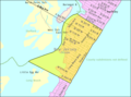
 Census Bureau map of Barnegat Light, New Jersey.png 575 × 425; 27 KB
-
 Census Bureau map of Beach Haven, New Jersey.png 575 × 425; 20 KB
-
 Census Bureau map of Harvey Cedars, New Jersey.png 575 × 425; 27 KB
-
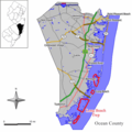
 Census Bureau map of Long Beach Township, New Jersey.png 575 × 425; 42 KB
-
 Census Bureau map of Ship Bottom, New Jersey.png 575 × 425; 31 KB
-
 Census Bureau map of Surf City, New Jersey.png 575 × 425; 32 KB
-
 Deep sea fishing grounds (1915) (20224911303).jpg 2,944 × 1,884; 539 KB
-
 Long beach twp nj 029.png 580 × 580; 49 KB
-
 LongBeachIsland.svg 1,864 × 1,967; 25 KB
-

-

-

-
 Ship bottom nj 029.png 580 × 580; 48 KB
-
 Surf city nj 029.png 580 × 580; 48 KB

_(20170558860).jpg)
_(20170560940).jpg)
_(20170562750).jpg)
_(20350114232).jpg)
_(20358618215).jpg)


_(20224911303).jpg)


