Category:Maps of Limousin
Appearance
Administrative regions and territorial collectivity of Metropolitan France (‡ since start of 2016):
Auvergne-Rhône-Alpes‡ · Bourgogne-Franche-Comté‡ · Brittany · Centre-Val de Loire · Corsica · Grand Est‡ · Hauts-de-France‡ · Île-de-France · Normandy‡ · Nouvelle-Aquitaine‡ · Occitania‡ · Pays de la Loire · Provence-Alpes-Côte d'Azur
Former administrative regions of Metropolitan France (until end of 2015):
Alsace · Aquitaine · Auvergne · Burgundy · Champagne-Ardenne · Franche-Comté · Languedoc-Roussillon · Limousin · Lorraine · Midi-Pyrénées · Nord-Pas-de-Calais · Lower Normandy · Upper Normandy · Picardy · Poitou-Charentes · Rhône-Alpes
Overseas departments and regions: Guadeloupe · Martinique · French Guiana · Réunion · Mayotte
Overseas collectivities: Saint Barthélemy · Saint-Martin · Saint Pierre and Miquelon · French Polynesia · Wallis and Futuna · French Southern and Antarctic Lands+
Sui generis territories: New Caledonia · Clipperton Island+
Use the appropriate category for maps showing all or a large part of Limousin. See subcategories for smaller areas:
| If the map shows | Category to use |
|---|---|
| Limousin on a recently created map | Category:Maps of Limousin or its subcategories |
| Limousin on a map created more than 70 years ago | Category:Old maps of Limousin or its subcategories |
| the history of Limousin on a recently created map | Category:Maps of the history of Limousin or its subcategories |
| the history of Limousin on a map created more than 70 years ago | Category:Old maps of the history of Limousin or its subcategories |
Wikimedia category | |||||
| Upload media | |||||
| Instance of | |||||
|---|---|---|---|---|---|
| Category combines topics | |||||
| Limousin | |||||
geographic region and former administrative region in France | |||||
| Instance of | |||||
| Named after | |||||
| Location | |||||
| Visitor center | |||||
| Capital | |||||
| Inception |
| ||||
| Dissolved, abolished or demolished date |
| ||||
| Area |
| ||||
| Replaced by | |||||
 | |||||
Subcategories
This category has the following 13 subcategories, out of 13 total.
!
- SVG maps of Limousin (2 F)
*
- Locator maps of Limousin (13 F)
M
- Maps of France in 1030 (11 F)
T
- Tour du Limousin maps (4 F)
Media in category "Maps of Limousin"
The following 66 files are in this category, out of 66 total.
-
-20 ans par cantons-1999-Limousin.jpg 500 × 500; 86 KB
-
-20ans1999-canton legende.jpg 190 × 148; 7 KB
-
12-Région-fr-Limousin-Loc-R2.png 482 × 449; 330 KB
-
Agriculture en Limousin.png 696 × 499; 86 KB
-
Basse Marche.png 783 × 863; 211 KB
-
Bassin de Brive.png 783 × 863; 212 KB
-
Carta dau Lemosin.svg 567 × 709; 971 KB
-
Carta Limotges quartiers.jpg 1,181 × 1,476; 334 KB
-
Carta occitan lemosin PDF.pdf 1,770 × 1,770; 1.66 MB
-
Carta occitan lemosin.jpg 1,772 × 1,772; 966 KB
-
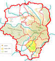
Carte des unités paysagères du plateau de Millevaches.png 630 × 613; 286 KB
-
Carte du Limousin.png 624 × 700; 120 KB
-
Carte Limousin.svg 1,860 × 1,351; 446 KB
-
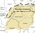
Carte linguistique de la Marche (avec Marchois).png 1,843 × 1,190; 694 KB
-
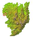
Carte physique du plateau de Millevaches.png 631 × 614; 306 KB
-
Carte physique du PNR Millevaches.png 655 × 638; 161 KB
-
Carte PNR Millevaches en Limousin, 2020.png 1,750 × 1,915; 614 KB
-
Carte PNR Millevaches en Limousin.png 534 × 692; 229 KB
-
Carte TER Limousin.png 1,510 × 1,529; 325 KB
-
Carte-V3.jpg 1,239 × 1,239; 349 KB
-
Carte-V31.jpg 1,243 × 1,239; 345 KB
-
CarteregionLimousin.jpg 500 × 500; 177 KB
-
Communes du plateau de Millevaches.png 667 × 736; 345 KB
-
Das Reich - Zone de Limoges 8-12 juin 1944.jpg 1,100 × 740; 344 KB
-
Dessertes TGV Poitiers Limoges Brive.png 374 × 457; 27 KB
-
Dordogne limousine.png 783 × 863; 215 KB
-
Etoile ferroviaire de Limoges.png 1,190 × 913; 158 KB
-
Evolution circonscriptions Limousin 1988-2007.png 435 × 350; 41 KB
-
France Limousin natural parks-fr.svg 649 × 604; 35 KB
-
G. Bruno - Le Tour de la France par deux enfants p124.jpg 1,180 × 832; 205 KB
-
Géologie.png 518 × 460; 40 KB
-
LGV Poitiers-Limoges projets.PNG 181 × 221; 5 KB
-
Limotges-sos quartiers e vilatges.pdf 1,179 × 1,475; 612 KB
-
Limousin (dialect).png 397 × 372; 48 KB
-
Limousin et marchois.png 1,806 × 1,005; 592 KB
-
Limousin Haute-Marche.png 783 × 863; 209 KB
-
Limousin Pays d'Ussel.png 783 × 863; 211 KB
-
Limousin Pays de Tulle.png 783 × 863; 211 KB
-
Limousin pays trads.png 783 × 863; 219 KB
-
Limousin stub.svg 498 × 544; 57 KB
-
Limousin Xaintrie.png 783 × 863; 211 KB
-
Limousin.jpg 1,672 × 1,348; 1.28 MB
-
Législatives Limousin 2007-2012.png 1,087 × 686; 468 KB
-
MC Toulx.jpg 714 × 784; 230 KB
-
Millevaches Gentioux la Courtine.png 904 × 520; 210 KB
-
Montagne limousine.png 783 × 863; 210 KB
-
Monts de fayat1.jpg 714 × 784; 248 KB
-
Monts du Limousin et de la Marche.png 627 × 609; 528 KB
-
Monts du Limousin.png 783 × 863; 317 KB
-
Monts du Limousin.svg 749 × 710; 34 KB
-
Occitan limousin selon Paul-Louis Grenier.png 387 × 309; 45 KB
-
Options initiales LGV Poitiers-Limoges.png 409 × 571; 64 KB
-
Ostensions limousine Carte.png 948 × 960; 194 KB
-
Ostensions limousine Carte2-01.svg 512 × 512; 136 KB
-
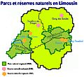
Parcs-réserves limousin.JPG 670 × 614; 61 KB
-
Pays d'Uzerche.png 783 × 863; 210 KB
-
Pays de Bourganeuf.png 783 × 863; 212 KB
-
Pays de la Souterraine.png 783 × 863; 212 KB
-
Pays de la Vienne.png 783 × 863; 208 KB
-
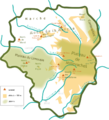
Plateau de Millevaches.PNG 859 × 780; 214 KB
-
Route-richardcoeurdelion.png 721 × 519; 94 KB
-
TER Limousin, fréquence de la desserte.png 1,050 × 1,431; 466 KB
-
Unités paysagères du plateau de Millevaches.png 613 × 609; 218 KB
-
Villages viticoles en Limousin.png 664 × 702; 68 KB
-
Vote 2nd tour présidentielle 2007 Limousin.png 579 × 588; 187 KB


