Category:Maps of Lazika
Jump to navigation
Jump to search
Wikimedia category | |||||
| Upload media | |||||
| Instance of | |||||
|---|---|---|---|---|---|
| Category combines topics | |||||
| Lazica | |||||
former country  Юго-восточное Причерноморье | |||||
| Instance of | |||||
| Location |
| ||||
| Capital | |||||
| Inception |
| ||||
| Dissolved, abolished or demolished date |
| ||||
| Said to be the same as | Lazica | ||||
| |||||
Media in category "Maps of Lazika"
The following 63 files are in this category, out of 63 total.
-
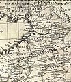
 Banduri and Lisle. Imperii Orientalis et Circumjacentium Regionum.C (Iberia, Lazica).jpg 1,048 × 1,513; 319 KB
-

-

-
 W. & A.K. Johnston. Asia Minor. 1911 BO.jpg 297 × 267; 29 KB
-
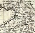
 Anville, Jean Baptiste Bourguignon. Turkey in Asia. 1794 (BD).jpg 1,196 × 708; 235 KB
-

-

-
 Bowen, Emanuel. Anatolia, Syria. 1747. (B).jpg 1,302 × 1,507; 602 KB
-
 Bowen, Emanuel. Anatolia, Syria. 1747. (C).jpg 1,302 × 1,215; 477 KB
-
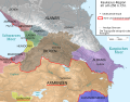
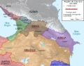
 Caucasus 250 AD map alt de.png 2,990 × 2,324; 3.53 MB
-
 Caucasus 250 AD map alt de.svg 1,155 × 898; 4.46 MB
-
 Caucasus 250 AD map alt es.svg 1,155 × 898; 1.03 MB
-
 Caucasus 250 AD map alt pt.svg 1,155 × 898; 4.46 MB
-
 Caucasus 250 AD map de.png 2,990 × 2,324; 3.53 MB
-
 Caucasus 250 AD map de.svg 1,155 × 898; 4.45 MB
-
 Caucasus 250 AD map hu.svg 1,155 × 898; 4.45 MB
-
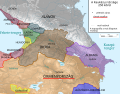
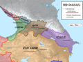
 Caucasus 300 map alt de.png 2,990 × 2,324; 3.02 MB
-
 Caucasus 300 map alt de.svg 1,155 × 898; 4.46 MB
-
 Caucasus 300 map de.png 2,990 × 2,324; 3.51 MB
-
 Caucasus 300 map de.svg 1,155 × 898; 4.44 MB
-
 Caucasus 300 map es.svg 1,155 × 898; 3.36 MB
-
 Caucasus 300 map pt.svg 1,155 × 898; 4.44 MB
-
 Caucasus 385 AD map alt de.png 3,000 × 2,332; 3.52 MB
-
 Caucasus 385 AD map alt de.svg 1,155 × 898; 4.44 MB
-
 Caucasus 385 AD map de.png 3,000 × 2,332; 3.54 MB
-
 Caucasus 385 AD map de.svg 1,155 × 898; 4.41 MB
-
 Caucasus 565 map de alt.png 2,990 × 2,324; 3.13 MB
-
 Caucasus 565 map de.png 2,990 × 2,324; 3.14 MB
-
 Caucasus 565 map de.svg 1,155 × 898; 4.44 MB
-
 Caucasus 565 map es.svg 1,155 × 898; 1.13 MB
-
 Caucasus 565 map hu.svg 1,155 × 898; 4.41 MB
-
 Caucasus 565n alt.svg 1,155 × 898; 4.44 MB
-
 Caucasus in 300 AD (Armenian - hy).png 1,127 × 833; 800 KB
-
 Ge iberia350.png 699 × 450; 39 KB
-
 Ge lazika-ar.png 376 × 300; 29 KB
-
 Ge lazika.png 376 × 300; 13 KB
-
 Ge lazika–ქა.png 376 × 300; 12 KB
-
 Georgia 1st 2nd centuries AD.svg 1,333 × 1,047; 532 KB
-
 Georgians.png 2,625 × 1,215; 205 KB
-
 Historical Lazona-Lazeti-Lazistan map.jpg 1,258 × 765; 1.05 MB
-
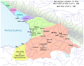
 Lazica in Late Antiquity-es.svg 1,038 × 935; 1.27 MB
-
 Lazica in Late Antiquity-fr.svg 1,038 × 935; 2.2 MB
-
 Lazica in Late Antiquity-pt.svg 1,038 × 935; 1.91 MB
-
 Lazica in Late Antiquity-tr.svg 1,038 × 935; 2.2 MB
-
 Lazica in Late Antiquity.svg 1,038 × 935; 2.28 MB
-
 Lazica tr.svg 770 × 520; 3.73 MB
-
 Lazica-pt.svg 770 × 520; 3.73 MB
-
 Lazica.he.svg 770 × 520; 3.73 MB
-
 Lazica.svg 770 × 520; 3.73 MB
-
 Lazika arm.png 298 × 174; 4 KB
-
 Laziska arm.png 298 × 174; 4 KB
-
 Lazistan Haritası - Map of Lazistan.tif 5,262 × 3,366, 2 pages; 10.78 MB
-

-
 Roman-Persian Frontier, 565 AD-es.svg 512 × 460; 1.57 MB
-
 Roman-Persian Frontier, 565 AD-pt.svg 512 × 460; 83 KB
-
 Roman-Persian Frontier, 565 AD-zh.svg 1,875 × 1,685; 344 KB
-
 Roman-Persian Frontier, 565 AD.png 838 × 775; 1.86 MB
-

-

-

-

-

-
 ლაზეთის რუკა - Map of Lazistan.jpg 5,262 × 3,366; 2.78 MB
.jpg)
.jpg)


.jpg)
.jpg)

.jpg)
.jpg)


.png)


.jpg)


.jpg)
.jpg)
.jpg)
.jpg)
.jpg)
