Category:Maps of La Bazouge-de-Chemeré
Jump to navigation
Jump to search
Wikimedia category | |||||
| Upload media | |||||
| Instance of | |||||
|---|---|---|---|---|---|
| Category combines topics | |||||
| La Bazouge-de-Chemeré | |||||
commune in Mayenne, France _%C3%89glise_01.JPG)  | |||||
| Instance of | |||||
| Location |
| ||||
| Street address |
| ||||
| Population |
| ||||
| Area |
| ||||
| official website | |||||
 | |||||
Media in category "Maps of La Bazouge-de-Chemeré"
The following 5 files are in this category, out of 5 total.
-
 53022-La Bazouge-de-Chemeré-Hydro.jpeg 5,846 × 4,133; 2.3 MB
-
 53022-La Bazouge-de-Chemeré-Sols.png 3,270 × 2,598; 2.22 MB
-
 LBDC carte Jaillot.jpg 1,019 × 744; 344 KB
-
 LBDC centre percé 1849.jpg 845 × 1,093; 269 KB
-
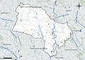
 Map commune FR insee code 53022.png 756 × 605; 49 KB


