Category:Maps of L'Île-d'Yeu
Jump to navigation
Jump to search
Wikimedia category | |||||
| Upload media | |||||
| Instance of | |||||
|---|---|---|---|---|---|
| Category combines topics | |||||
| L'Île-d'Yeu | |||||
commune in Vendée, France  .svg)  | |||||
| Instance of | |||||
| Location | |||||
| Population |
| ||||
| Area |
| ||||
| Elevation above sea level |
| ||||
| official website | |||||
 | |||||
Media in category "Maps of L'Île-d'Yeu"
The following 12 files are in this category, out of 12 total.
-
 85-AAV2020-Les Sables-d'Olonne.png 3,519 × 2,930; 1.55 MB
-
 85-L'Île-d'Yeu-AAV2020.png 3,519 × 2,930; 437 KB
-
 85113-L'Île-d'Yeu-Hydro.jpeg 5,846 × 4,133; 1.92 MB
-
 85113-L'Île-d'Yeu-Sols.png 3,270 × 2,598; 2.13 MB
-
 Carte ile d yeu.png 800 × 535; 21 KB
-
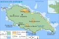
 Ile d'yeu satellite.png 500 × 500; 158 KB
-
 Map commune FR insee code 85113.png 756 × 605; 39 KB
-
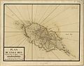 Plan de l'ile Dieu 1788.jpg 1,261 × 994; 805 KB
-
 Yeu carte thématique-fr.svg 913 × 534; 921 KB
-
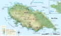
 Yeu topo-fr.svg 800 × 535; 226 KB
-
 Île d'Yeu topographic map-fr.svg 913 × 534; 918 KB
-
 Île d'Yeu.png 753 × 492; 602 KB


