Category:Maps of Kyushu
Jump to navigation
Jump to search
Wikimedia category | |||||
| Upload media | |||||
| Instance of | |||||
|---|---|---|---|---|---|
| Category combines topics | |||||
| Kyushu | |||||
third largest island of Japan  L'illa de Kyūshū en imatge des de satèl·lit    | |||||
| Instance of | |||||
| Part of |
| ||||
| Named after | |||||
| Location | |||||
| Located in or next to body of water | |||||
| Highest point |
| ||||
| Population |
| ||||
| Area |
| ||||
 | |||||
Subcategories
This category has the following 7 subcategories, out of 7 total.
M
Media in category "Maps of Kyushu"
The following 52 files are in this category, out of 52 total.
-
 Admiralty Chart No 127 Hirado Seto to Shimonoseki Kaikyo, Published 1961.jpg 16,404 × 11,317; 53.82 MB
-
 Admiralty Chart No 2026 Matsu Shima to Kuro Shima, Published 1935.jpg 11,168 × 16,238; 59.24 MB
-
 Admiralty Chart No 358 Kyushu and Honshu including the Korea Strait, Published 1962.jpg 11,219 × 16,380; 40.46 MB
-
 Admiralty Chart No 626 Plans in South East Kyushu, Published 1954.jpg 11,280 × 8,217; 27.18 MB
-
 Airfields in kyushu 15 august 1945.jpg 587 × 732; 99 KB
-
 E-Kaempfer-Nagasaki-Kaido.jpg 4,233 × 3,417; 10.85 MB
-
 Eight regions of japan8 kyusyu.png 500 × 600; 27 KB
-
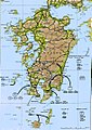
 Geofeatures map of Kyushu Japan ja.svg 701 × 882; 2.47 MB
-
 Isahaya-bay.jpg 344 × 337; 95 KB
-
 Japan Kyushu Map Chikei.gif 400 × 430; 56 KB
-
 Japan kyushu map small.png 235 × 300; 6 KB
-
 Japan Kyushu Map.png 2,836 × 3,000; 1.89 MB
-
 Japan Kyushu Map.svg 2,838 × 3,005; 2.78 MB
-
 Japan Kyushu Region large.png 1,397 × 1,593; 74 KB
-
 Japan Kyushu Region.png 399 × 429; 20 KB
-
 Japan Kyusyu Map.png 2,836 × 3,000; 1.84 MB
-
 Japan Kyusyu Map.svg 3,004 × 3,004; 2.77 MB
-
 Japan South Kyushu Region 2.png 1,397 × 1,593; 89 KB
-
 Japan South Kyushu Region.png 1,397 × 1,593; 89 KB
-
 JpLargeMap Kyushu-A.png 1,260 × 919; 44 KB
-
 JpLargeMap Kyushu-B.png 1,260 × 919; 20 KB
-
 JpLargeMap Kyushu-C.png 1,260 × 919; 7 KB
-
 Kyushu hrdist map 2003.PNG 1,100 × 847; 65 KB
-
 Kyushu Japan location map Provinces 2.png 600 × 600; 110 KB
-
 Kyushu Japan location map.svg 400 × 400; 827 KB
-
 Kyushu map.png 598 × 672; 101 KB
-
 Kyushu Region Administration Map TC.png 600 × 600; 49 KB
-
 Kyushu Region in Japan (extended).svg 580 × 578; 1.58 MB
-
 Kyushu Region in Japan (narrow).svg 271 × 363; 1.72 MB
-
 Kyushu relief map.svg 701 × 882; 1.77 MB
-
 Kyushu s.png 345 × 683; 17 KB
-
 Kyushu Tom.jpg 1,440 × 1,840; 346 KB
-
 Kyushu-jp.png 631 × 1,120; 385 KB
-
 Kyushu-region Small.png 199 × 228; 2 KB
-
 Kyushu.png 690 × 1,365; 27 KB
-
 Kyushumap-en.png 631 × 1,120; 389 KB
-
 Kyusyu Tom.jpg 1,774 × 2,051; 358 KB
-
 Map of the nine provinces of Kyūshū (14498334687).jpg 2,500 × 1,734; 2.16 MB
-
 Map of the nine provinces of Kyūshū (14579310033).jpg 2,500 × 1,868; 2.01 MB
-
 Nishi Kyusyu Shinkansen KAMOME route maps.png 1,223 × 1,700; 407 KB
-
 Objective airfields in kyushu 15 august 1945.jpg 1,168 × 1,445; 650 KB
-
 Operation Downfall - Estimated Troops 01.jpg 551 × 632; 74 KB
-
 Operation Downfall - Estimated Troops 02.jpg 549 × 633; 82 KB
-
 Operation Olympic.jpg 753 × 1,065; 246 KB
-
 R3-2-017.jpg 2,816 × 1,584; 1.48 MB
-
 SouthernJapan-region Small.png 199 × 228; 2 KB
-
 Topographic map of Kyushu.png 2,285 × 2,285; 7.32 MB
-
 Topographic northern kyushu.png 600 × 445; 52 KB
-
 Yasuhiro Tanabe.jpg 400 × 300; 123 KB
-
 Карта Кюсю.png 1,017 × 833; 673 KB
-
 九州北部の図.jpg 3,968 × 2,976; 2.31 MB
-
 旅で応援、行こうよ!九州.jpg 298 × 386; 680 KB


.svg)
.svg)


.jpg)
.jpg)


