Category:Maps of Karnataka
Jump to navigation
Jump to search
States of India: Andhra Pradesh · Arunachal Pradesh · Assam · Bihar · Chhattisgarh · Goa · Gujarat · Haryana · Himachal Pradesh · Jharkhand · Karnataka · Kerala · Madhya Pradesh · Maharashtra · Manipur · Meghalaya · Mizoram · Nagaland · Odisha · Punjab · Rajasthan · Sikkim · Tamil Nadu · Telangana · Tripura · Uttar Pradesh · Uttarakhand · West Bengal
Union territories: Andaman and Nicobar Islands · Chandigarh · Dadra and Nagar Haveli and Daman and Diu · Delhi · Jammu and Kashmir · Ladakh · Lakshadweep · Puducherry
Former states of India: Jammu and Kashmir ·
Former union territories: Dadra and Nagar Haveli district · Daman and Diu ·
Union territories: Andaman and Nicobar Islands · Chandigarh · Dadra and Nagar Haveli and Daman and Diu · Delhi · Jammu and Kashmir · Ladakh · Lakshadweep · Puducherry
Former states of India: Jammu and Kashmir ·
Former union territories: Dadra and Nagar Haveli district · Daman and Diu ·
Wikimedia category | |||||
| Upload media | |||||
| Instance of | |||||
|---|---|---|---|---|---|
| Category combines topics | |||||
| Karnataka | |||||
Indian state   someja satełitar in disenbre  .svg)  | |||||
| Instance of |
| ||||
| Part of | |||||
| Location | India | ||||
| Capital | |||||
| Legislative body |
| ||||
| Executive body | |||||
| Official language | |||||
| Head of state |
| ||||
| Head of government |
| ||||
| Inception |
| ||||
| Population |
| ||||
| Area |
| ||||
| Follows |
| ||||
| Replaces |
| ||||
| Different from | |||||
| official website | |||||
 | |||||
Subcategories
This category has the following 19 subcategories, out of 19 total.
Pages in category "Maps of Karnataka"
This category contains only the following page.
Media in category "Maps of Karnataka"
The following 31 files are in this category, out of 31 total.
-
 Alvakheda map.jpg 412 × 586; 36 KB
-
 Distance from major cities to North Karnataka.jpg 533 × 771; 101 KB
-
 Districts affected by Sept 2008 Hindu-Christian conflict.png 415 × 600; 76 KB
-
 Hayyal (B), Wadagera Map.jpg 3,264 × 3,264; 939 KB
-
 India Karnataka Divisions map.png 1,439 × 2,048; 603 KB
-
 India Karnataka location map.png 851 × 1,211; 345 KB
-
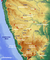
 India Karnataka relief map.png 1,634 × 2,367; 2.56 MB
-
 Karnataka in OSM 2015.png 748 × 711; 429 KB
-
 Karnataka INC+JD(S) Seat Sharing.png 800 × 851; 136 KB
-
 Karnataka outline shape.svg 300 × 300; 159 KB
-
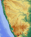
 Karnataka physical map.png 669 × 711; 835 KB
-
 Karnataka Rail Network.svg 744 × 1,052; 1.08 MB
-
 Karnataka soil map NBSS.png 10,410 × 15,151; 143.88 MB
-
 Karnataka State Regions.svg 2,100 × 2,400; 148 KB
-
 Karnataka stats.jpg 798 × 1,151; 380 KB
-
 Karnataka topo deu.png 637 × 765; 893 KB
-
 Karnataka topo leer.png 637 × 765; 894 KB
-
 Karnataka.jpj.jpg 1,600 × 1,689; 130 KB
-
 Kodagu and Tulunad Map.jpg 459 × 495; 40 KB
-
 Koppa Taluk map.png 3,160 × 3,021; 3.32 MB
-
 Literacyupload122.jpg 800 × 1,156; 213 KB
-
 Lok Sabha Constituencies in Karnataka by Assembly seats.pdf 1,062 × 1,537; 431 KB
-
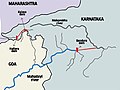 Mahadayi river.jpg 384 × 288; 25 KB
-
 Map of Belawadi province.jpg 1,097 × 1,353; 80 KB
-
 Map of Karnataka.svg 372 × 572; 338 KB
-
 Mysore division.svg 1,630 × 2,356; 147 KB
-
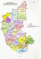
 Political map of Indian state of Karnataka.png 1,439 × 2,048; 766 KB
-
 Sivanasamudra-water-falls-ml.png 983 × 1,600; 105 KB
-
 Southern Railways.jpg 3,419 × 4,118; 11.45 MB
-
 Taluks of Karnataka - 2011 Census.pdf 1,883 × 2,610; 2.18 MB
-
 Tulunadu sites.jpg 305 × 341; 62 KB


,_Wadagera_Map.jpg)


_Seat_Sharing.png)


