Category:Maps of Jerusalem from 1949
Jump to navigation
Jump to search
Media in category "Maps of Jerusalem from 1949"
The following 33 files are in this category, out of 33 total.
-
 1949 Jerusalem.svg 512 × 739; 199 KB
-
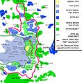
 1949-67-JerusalemMap-he.svg 395 × 589; 254 KB
-
 A part of a map of East Jerusalem.PNG 493 × 195; 149 KB
-
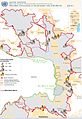
 Barrier north Jerusalem.jpg 809 × 834; 362 KB
-

-
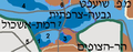
 East Jerusalem Map HE1a1.PNG 388 × 704; 352 KB
-
 EastJerusalemMap-2.png 500 × 767; 26 KB
-
 EastJerusalemMap-de.svg 384 × 589; 87 KB
-
 EastJerusalemMap-en.svg 384 × 589; 88 KB
-
 EastJerusalemMap-es.svg 384 × 589; 88 KB
-
 EastJerusalemMap.jpg 582 × 593; 85 KB
-
 EastJerusalemMapAR.jpg 582 × 593; 224 KB
-
 EastJerusalemMapHE.jpg 582 × 593; 228 KB
-
 EastJerusalemMapHE1a.PNG 582 × 593; 369 KB
-
 Exhibits at the Israeli Police Heritage Center IMG 1697.JPG 2,304 × 3,456; 4.27 MB
-
 Exhibits at the Israeli Police Heritage Center IMG 1700.JPG 2,304 × 3,456; 3.68 MB
-
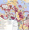
 Expanded Jerusalem 1967.jpg 868 × 1,346; 256 KB
-
 Greater Jerusalem May 2006 CIA remote-sensing map 3500px.jpg 3,500 × 4,530; 5.54 MB
-
 Greater Jerusalem May 2006 CIA remote-sensing map.jpg 8,264 × 10,696; 53.3 MB
-
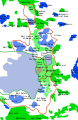
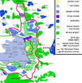
 Jerusalem 1949-1967 sv.png 610 × 653; 20 KB
-
 Jerusalem Israel Map.png 287 × 273; 14 KB
-
 Jerusalem separation wall.svg 1,609 × 1,397; 724 KB
-
 Jerusalem-barrier July 2011-OCHAoPt.jpeg 1,253 × 1,826; 293 KB
-
 Jerusalem-barrier June 2007-OCHAoPt.jpeg 1,159 × 1,092; 190 KB
-
 Map of jerusalem he.svg 850 × 1,250; 298 KB
-
 NorthEastJerusalemMap1.JPG 471 × 342; 44 KB
-
 NorthEastJerusalemMap2.JPG 426 × 294; 36 KB
-

-
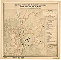 UN Map of Central Jerusalem November 1949.jpg 3,384 × 3,292; 2.23 MB
-
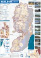 West Bank Access Restrictions June 2020.pdf 4,964 × 7,020; 15.18 MB
-
 Westbankjan06-jerusalem-etzion.jpg 582 × 568; 87 KB
-
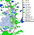
 Westbankjan06-modiin-jerusalem-etzion.jpg 1,433 × 941; 240 KB
-
 Zone e1-emplacement approximatif.jpg 1,159 × 1,092; 354 KB


.jpg)


