Category:Maps of Isle-Saint-Georges
Jump to navigation
Jump to search
Wikimedia category | |||||
| Upload media | |||||
| Instance of | |||||
|---|---|---|---|---|---|
| Category combines topics | |||||
| Isle-Saint-Georges | |||||
commune in Gironde, France .jpg) .svg)  | |||||
| Instance of | |||||
| Location |
| ||||
| Located in or next to body of water | |||||
| Population |
| ||||
| Area |
| ||||
| official website | |||||
 | |||||
Media in category "Maps of Isle-Saint-Georges"
The following 8 files are in this category, out of 8 total.
-
 33206-Isle-Saint-Georges-argile.jpg 3,057 × 2,480; 508 KB
-
 33206-Isle-Saint-Georges-relief.png 3,057 × 2,480; 3.01 MB
-
 33206-Isle-Saint-Georges-Routes-Hydro.png 3,507 × 2,480; 1.97 MB
-
 33206-Isle-Saint-Georges-Sols.png 3,270 × 2,598; 2.03 MB
-
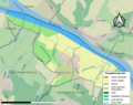
 33206-Isle-Saint-Georges-ZNIEFF2.png 5,866 × 4,133; 5.44 MB
-
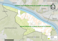
 Isle-Saint-Georges (Gironde) dans son Arrondissement.png 2,000 × 2,467; 641 KB
-
 Isle-Saint-Georges Limite communale.jpg 949 × 578; 184 KB
-
 Map commune FR insee code 33206.png 756 × 605; 49 KB


_dans_son_Arrondissement.png)
