Category:Maps of Isla Margarita
Jump to navigation
Jump to search
Wikimedia category | |||||
| Upload media | |||||
| Instance of | |||||
|---|---|---|---|---|---|
| Category combines topics | |||||
| Margarita Island | |||||
island in Nueva Esparta, Venezuela  Juan Griego Bay vum Fort La Galera aus gesinn  | |||||
| Audio | |||||
| Instance of | |||||
| Part of | |||||
| Location | |||||
| Located in or next to body of water | |||||
| Anthem |
| ||||
| Width |
| ||||
| Length |
| ||||
| Highest point |
| ||||
| Population |
| ||||
| Area |
| ||||
 | |||||
Subcategories
This category has only the following subcategory.
Media in category "Maps of Isla Margarita"
The following 13 files are in this category, out of 13 total.
-
 Nueva Esparta in Venezuela (special marker).svg 1,654 × 1,479; 1.3 MB
-

-
 1632 Cardona Descripcion Indias (37).jpg 4,245 × 2,887; 1.13 MB
-
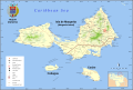
 Caribbean - Isla Margarita.PNG 929 × 606; 48 KB
-
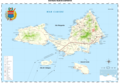
 Isla-de-Margarita-map-1840-Codazzi.jpg 854 × 605; 150 KB
-
 La Marguerite - thevet - btv1b8596490f.jpg 3,059 × 2,499; 1.62 MB
-
 Map of Nueva Esparta.svg 3,516 × 2,373; 1.99 MB
-
 Nueva Esparta Map English.svg 3,604 × 2,431; 2.23 MB
-
 Nueva Esparta Mapa Vial librsvg.png 3,612 × 2,508; 1.44 MB
-
 Nueva Esparta Mapa Vial rendersvg.png 3,612 × 2,508; 1.41 MB
-
 Nueva Esparta Mapa Vial.svg 3,612 × 2,508; 1.42 MB
-
 Provincia Margarita.jpg 4,592 × 3,152; 10.88 MB
-
 Rigobert-Bonne-Atlas-de-toutes-les-parties-connues-du-globe-terrestre MG 0018.tif 3,536 × 5,263; 53.28 MB
.svg)
.jpg)
.jpg)


