Category:Maps of Indochina
Jump to navigation
Jump to search
Wikimedia category | |||||
| Upload media | |||||
| Instance of | |||||
|---|---|---|---|---|---|
| Category combines topics | |||||
| Mainland Southeast Asia | |||||
region in Southeast Asia   | |||||
| Instance of | |||||
| Part of | |||||
| Location | Southeast Asia | ||||
| Located in or next to body of water | |||||
| Has part(s) | |||||
| Area |
| ||||
| Different from | |||||
| Partially coincident with | |||||
 | |||||
Subcategories
This category has the following 4 subcategories, out of 4 total.
F
M
V
Media in category "Maps of Indochina"
The following 139 files are in this category, out of 139 total.
-
 '1928 Indochine.jpg 6,056 × 8,436; 8.71 MB
-
 (Carte d'étude) btv1b8458797n.jpg 4,979 × 6,021; 3.54 MB
-
-
 Southeast Asia 1684.png 1,415 × 1,960; 4.06 MB
-
 A new chart of the China, with its several entrances.jpg 7,728 × 11,402; 11.95 MB
-
 1945 Indochina Roads (30252751134).jpg 7,255 × 9,047; 5.72 MB
-
 1951 Indochina (30583518180).jpg 1,395 × 1,883; 1.44 MB
-
 An Nam Dai Quoc Hoa Do by Jean Louis Taberd 1838.jpg 3,500 × 6,111; 14.05 MB
-
 Asia and its islands.png 15,898 × 6,819; 158.56 MB
-
 Asiatic Archipelago.png 10,858 × 8,476; 86.85 MB
-
 Atlas colonial français Colonies Protectorats (...)Pollacchi Paul bpt6k1100182m.jpg 5,367 × 3,905; 5.83 MB
-
 Atlas de l'Indochine dressé (...)Indochine française bpt6k11001779 67.jpg 8,040 × 5,752; 6.06 MB
-
 Atlas de l'Indochine dressé (...)Indochine française bpt6k11001779 70.jpg 5,555 × 8,448; 5.95 MB
-
 Atlas de l'Indochine dressé (...)Indochine française bpt6k11001779 73.jpg 5,840 × 8,515; 18.28 MB
-
 Atlas de l'Indochine dressé (...)Indochine française bpt6k11001779 76.jpg 8,383 × 5,926; 17.78 MB
-
 BacTrangKienDuyenVanViSonTamBachLongVi.jpg 1,020 × 1,080; 579 KB
-
 Bandotongthe.jpg 478 × 838; 159 KB
-
 Brockhaus and Efron Encyclopedic Dictionary b25 160-0.jpg 3,465 × 2,552; 3.32 MB
-
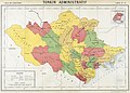
 Carte administrative des territoires militaires et postes militaires du Tonkin.jpg 4,600 × 3,203; 8.08 MB
-
 Carte de l'Indochine Routes chemins (...)Indochine française btv1b530574891 1.jpg 1,024 × 1,327; 307 KB
-
 Carte des postes du Tonkin 1888.jpg 7,448 × 5,736; 5.6 MB
-
 Carte des royaumes de Siam, de Tunquin, Pegu, Ava Aracan.jpg 7,114 × 5,002; 6.16 MB
-
 Carte du Royaume de Siam et de la Cochinchine Française (34427017492).jpg 1,200 × 1,709; 800 KB
-
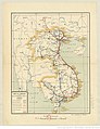
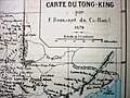 Carte du Tong-king 1879.JPG 1,600 × 1,200; 508 KB
-
 Carte du Tonkin dressée par le capitaine.jpg 6,492 × 7,655; 6.81 MB
-
 Carte du Tonkin.jpg 8,176 × 10,378; 11.06 MB
-
-
 Carte generale des Indes Orientales.png 8,386 × 6,592; 63.72 MB
-
 Carte geáneárale des Indes en-deça at au-dela du Gange, juin 1821.jpg 6,625 × 4,859; 4.73 MB
-
-
 Carte routière du Tonkin.jpg 17,549 × 13,609; 27.37 MB
-
 China and the Birman empire with parts of Cochin China and Siam.jpg 7,150 × 6,154; 20.4 MB
-
 China, Indo-China, Malaysia.jpg 5,282 × 6,994; 19.94 MB
-
 Chine, Et Indes Avec Les Isles.png 10,099 × 6,353; 84.56 MB
-
 Cochinchina 1914.jpg 3,623 × 4,715; 2.32 MB
-
 Cochinchine 1882.jpg 12,634 × 9,156; 12.73 MB
-

-
 Composite Map East Indies (cropped).png 1,691 × 2,041; 5.58 MB
-
 Composite Map East Indies.png 13,465 × 7,904; 142.65 MB
-
 D079- Route de Canton à Calcutta -liv2-ch11.png 1,446 × 1,962; 325 KB
-
 D225- Indo-Chine continentale -liv2-ch13.png 1,444 × 1,542; 399 KB
-
 DaiNam1844.jpg 3,100 × 4,400; 6.46 MB
-
 Die Ostindischen Inseln.png 10,015 × 8,093; 94.14 MB
-
 DongDuong1883.jpg 2,030 × 2,790; 1.46 MB
-
 DongDuong1914.jpg 5,135 × 3,915; 3.8 MB
-
 East India Isles.png 11,481 × 7,144; 137.15 MB
-
 Eastern Islands, Birmah &c.png 5,904 × 7,800; 62.29 MB
-
 Ethnolinguistic map of Indochina 1970.jpg 1,976 × 2,994; 654 KB
-
 Exposition geographique XIII Tableau Comprenant L'Asie et l'Afrique.png 11,260 × 8,291; 121.06 MB
-
 Greater Mekong Subregion Economic Corridors.jpg 1,219 × 1,665; 504 KB
-
 Hinter Indien.jpg 11,660 × 8,685; 38.28 MB
-
 Hinter-Indien u. Archipel.png 12,235 × 8,781; 141.84 MB
-
 Hinter-Indien, 1876.jpg 4,200 × 5,265; 12.4 MB
-
-
 Indo-Chine orientale - par J. L. Dutreuil de Rhins... 1879 - btv1b84389400.jpg 4,584 × 7,308; 4.88 MB
-

-
 Indochina 1902.jpg 9,034 × 5,992; 8.35 MB
-
 Indochina 1954-es.svg 703 × 1,013; 665 KB
-
 Indochina 1976-1978 map de.svg 1,088 × 1,544; 1.92 MB
-
 Indochina 1979 map de.svg 1,088 × 1,544; 1.96 MB
-
 Indochina Banner.jpg 6,818 × 975; 592 KB
-
 Indochina blank relief map.svg 543 × 771; 596 KB
-
 Indochina Boundaries - DPLA - 1db0d8b38b570d43cbed36817ebae99d.jpg 6,176 × 7,905; 5.18 MB
-
 Indochina Ethnolinguistic Groups (1970).jpg 2,618 × 4,048; 2.13 MB
-
 Indochina map 1886.jpg 1,626 × 2,114; 533 KB
-
 Indochina map.PNG 508 × 397; 11 KB
-
 Indochina Peninsula.png 300 × 250; 6 KB
-
 Indochina roads - OSS - btv1b53196959v.jpg 7,340 × 9,146; 7.71 MB
-
 Indochina, 1967.jpg 2,900 × 4,096; 2.4 MB
-
 Indochina,1954.jpg 452 × 681; 78 KB
-
 Indochina-20 july 1954-fr.svg 703 × 1,013; 1.75 MB
-
 Indochina.PNG 1,425 × 638; 47 KB
-
 IndoChina1886.jpg 1,573 × 2,079; 875 KB
-
 Indochinaambush.svg 741 × 606; 63 KB
-
 Indochine - btv1b53066691k.jpg 10,543 × 13,655; 17.94 MB
-
 Indochine - btv1b53121410c.jpg 10,480 × 13,760; 19.54 MB
-
 Indochine - btv1b8458819s.jpg 5,182 × 6,454; 3.5 MB
-
 Indochine - btv1b8458820f.jpg 5,698 × 7,294; 4.2 MB
-
 Indochine - btv1b8458821v.jpg 6,525 × 8,326; 5.45 MB
-
 Indochine - btv1b8459629s.jpg 5,688 × 7,374; 4.17 MB
-
 Indochine - Cochinchine. Cambodge. Annam. Bas-Laos - btv1b53192640w.jpg 9,602 × 8,562; 13.56 MB
-

-
 Indochine en relief. Indochine française et les régions environnantes au - btv1b84590007.jpg 8,022 × 10,518; 9.26 MB
-
 Indochine forestière. 1 - 2.000.000 - Carte établie par Maurand... - btv1b53189374w.jpg 7,652 × 10,866; 7.51 MB
-
 Indochine française - btv1b53066723z.jpg 6,859 × 9,230; 10.15 MB
-

-
 Indochine géologique - btv1b531893720.jpg 7,662 × 10,880; 9.74 MB
-

-
 Indochine physique - btv1b530651759.jpg 15,372 × 21,849; 34.37 MB
-
 Indochine physique - btv1b53065277k.jpg 15,646 × 21,953; 34.23 MB
-

-
 Indochine physique, politique et économique - par E. Girard... - btv1b530652999.jpg 12,049 × 15,464; 34.19 MB
-
 Indochine. Carte bathymétrique et des pêcheries - btv1b53196999h.jpg 7,870 × 10,740; 11.71 MB
-
 Indochine. Carte d'étude - btv1b53064917d.jpg 8,016 × 11,072; 12.9 MB
-
 Indochine. Carte d'étude - btv1b53065239t.jpg 7,864 × 11,248; 9.47 MB
-
 Indochine. Carte d'étude - btv1b53065270f.jpg 7,616 × 9,856; 8.65 MB
-
 Indochine. Carte d'étude - btv1b8458794d.jpg 7,390 × 10,037; 8.16 MB
-
 Indochinese Peninsula ja.png 463 × 655; 12 KB
-
 L'Indocina (India Transgangetica) le insole Filippine.png 10,026 × 7,827; 105.55 MB
-
 Large-scale-old-political-map-of-china-indochina-and-part-of-malasysia-1897.jpg 5,980 × 8,510; 18.41 MB
-
 Malay Archipelago, Or East India Islands.png 4,700 × 3,750; 25.77 MB
-
 Malay Archipelago.png 7,150 × 6,154; 61.17 MB
-
 Map of Burma, Siam, Cochin-China and Malaya.png 5,521 × 6,674; 44.14 MB
-
 Map of Cochinchina.jpg 4,925 × 6,847; 5.97 MB
-
 Map of Eastern Indochina WDL523.png 1,024 × 1,535; 2.96 MB
-
 Map of Indochina WDL312.png 1,024 × 1,343; 2.82 MB
-
 Map of Siam and French Indochina -by Milenioscuro- (modified Thai language).png 1,039 × 1,726; 586 KB
-
 Map of the Burman Empire.jpg 5,148 × 7,163; 3.85 MB
-
 Map of the Kingdoms of Siam, Tunquin, Pegu, Ava Aracan WDL311.png 1,456 × 1,024; 2.61 MB
-
 Map of the Kingdoms of Siam, Tunquin, Pegu, Ava Aracan WDL311.tif 7,114 × 5,002; 101.83 MB
-
 Map of Tonkin in the 1800s.jpg 10,102 × 7,931; 10.6 MB
-
 Map of Vietnam 1829.jpg 3,464 × 5,200; 8.83 MB
-
 Maps of Cochinchina 1891.jpg 2,899 × 4,095; 1.93 MB
-
 Maps of Indochina 1891 01.jpg 2,928 × 4,166; 2.28 MB
-
 Maps of Tonkin 1891.jpg 3,976 × 2,922; 2.34 MB
-

-
 Nam Định 1924.jpg 7,441 × 4,768; 8.52 MB
-
 Ost-Indien Mit Den Inseln. (East Indies).jpg 9,288 × 7,537; 25.26 MB
-
 Ostindischen Inseln.jpg 9,850 × 7,575; 32.49 MB
-
 Ostindischen Inseln.png 10,776 × 8,864; 96.31 MB
-
 ParacelBank1791.jpg 1,883 × 3,050; 866 KB
-
 Siam, Indochina and Malaya LOC 2014589786.jpg 3,088 × 4,116; 2.21 MB
-
 South Eastern Asia.png 8,160 × 6,570; 52.12 MB
-
 Southeast Asia, Birman Empire & Countries South and East of the Ganges, 1831.jpg 8,558 × 10,328; 5.28 MB
-
-
 Tong-King gravé par J. Geisendörfer.jpg 7,255 × 9,082; 7.25 MB
-
 Tonkin 1885.jpg 11,056 × 8,728; 7.58 MB
-
 Tonkin 1889-1895 (2).jpg 10,864 × 8,178; 12.54 MB
-
 Tonkin 1889-1895.jpg 10,260 × 7,774; 10.05 MB
-
 Tonkin 1914 (2).jpg 7,460 × 4,799; 4.96 MB
-
 Tonkin 1914 (3).jpg 7,448 × 4,871; 5.58 MB
-
 Tonkin 1914.jpg 7,304 × 4,679; 4.6 MB
-
 Tonkin 1930.jpg 9,232 × 6,672; 7.55 MB
-
 Tonkin in the 1800s.jpg 5,288 × 6,810; 5.37 MB
-
 Tonkin1889.jpg 15,461 × 12,159; 26.98 MB
-
 Universiteitsbibliotheek VU - Indo-Chine - carte de la mission Pavie.jpg 3,390 × 4,423; 3.46 MB
-

-

-
 កូសាំងស៊ីន(Cochinchina).jpg 667 × 600; 137 KB

_btv1b8458797n.jpg)
%27_(11245449595).jpg)


.jpg)
.jpg)


Pollacchi_Paul_bpt6k1100182m.jpg)
Indochine_fran%C3%A7aise_bpt6k11001779_67.jpg)
Indochine_fran%C3%A7aise_bpt6k11001779_70.jpg)
Indochine_fran%C3%A7aise_bpt6k11001779_73.jpg)
Indochine_fran%C3%A7aise_bpt6k11001779_76.jpg)


Indochine_fran%C3%A7aise_btv1b530574891_1.jpg)


.jpg)


_(14578915628).jpg)
.png)


.jpg)


.png)


.jpg)


_(14796560713).jpg)


.jpg)

.jpg)
.jpg)


.jpg)
.jpg)
_le_insole_Filippine.png)